MyTopo
Edgemoor South Carolina US Topo Map
Couldn't load pickup availability
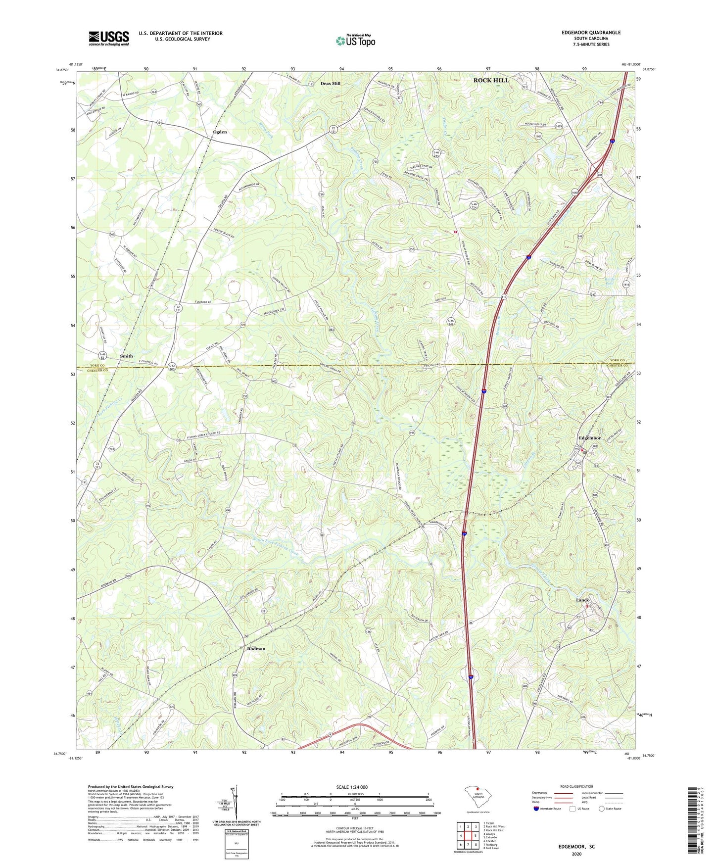
2024 topographic map quadrangle Edgemoor in the state of South Carolina. Scale: 1:24000. Based on the newly updated USGS 7.5' US Topo map series, this map is in the following counties: Chester, York. The map contains contour data, water features, and other items you are used to seeing on USGS maps, but also has updated roads and other features. This is the next generation of topographic maps. Printed on high-quality waterproof paper with UV fade-resistant inks.
Quads adjacent to this one:
West: Lowrys
Northwest: Tirzah
North: Rock Hill West
Northeast: Rock Hill East
East: Catawba
Southeast: Fort Lawn
South: Richburg
Southwest: Chester
This map covers the same area as the classic USGS quad with code o34081g1.
Contains the following named places: Antioch United Methodist Church, Big Calvary Church, Browns Branch, Cedar Grove Church, Cedar Grove School, Clinton Branch, Crawford Community College, Crawford School, Deas Mill, Edgemoor, Edgemoor Associate Reformed Presbyterian Church, Edgemoor High School, Fishing Creek Church, Fishing Creek School, Hicklin Branch, Hicklin Crossing, Hopewell Church, Lando, Lando Fire Department - Chester County Company 4, Lando Fire Department Edgemoor Substation, Miss Swiss Dairy, Mount Holly School, Mount Holly United Methodist Church, Oak Grove Church, Oakdale Fire Department Station 2, Oakley Hall School, Ogden, Ogden Church, Ogden School, Pinetuck Golf Course, Pleasant Grove Church, Pleasant Grove School, Pleasant Ridge Baptist Church, Pleasant Ridge School, Rehoboth Church, Reids Pool, Richburg Fire Department Station 2, Rodman, Smith, Smith Church, Smiths School, South Fork Fishing Creek, Stony Fork, Taylor Creek, WNSC-FM (Rock Hill), WNSC-TV (Rock Hill), Zion Church, ZIP Code: 29724