MyTopo
Long Branch South Carolina US Topo Map
Couldn't load pickup availability
Also explore the Long Branch Forest Service Topo of this same quad for updated USFS data
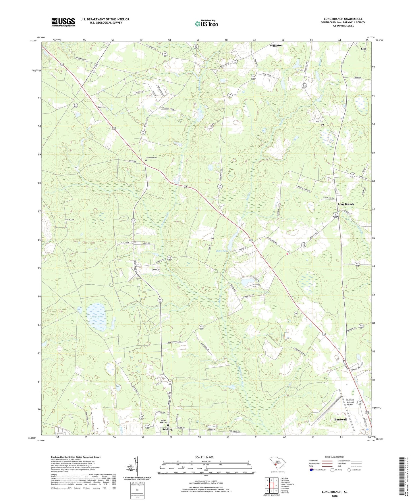
2024 topographic map quadrangle Long Branch in the state of South Carolina. Scale: 1:24000. Based on the newly updated USGS 7.5' US Topo map series, this map is in the following counties: Barnwell. The map contains contour data, water features, and other items you are used to seeing on USGS maps, but also has updated roads and other features. This is the next generation of topographic maps. Printed on high-quality waterproof paper with UV fade-resistant inks.
Quads adjacent to this one:
West: New Ellenton SE
Northwest: Windsor
North: Williston
Northeast: Springfield
East: Blackville
Southeast: Barnwell
South: Snelling
Southwest: Girard NE
This map covers the same area as the classic USGS quad with code o33081c4.
Contains the following named places: Andersons Pond D-3059 Dam, Barnwell Army Air Field, Barnwell County, Barnwell County Sheriff's Office, Barnwell Regional Airport, Bates Cemetery, Bates Pond D-3072 Dam, Bell Pond Baptist Church, Bell Pond School, Bells Mill, Bolen Pond, Bolens Fishing Lake D-3063 Dam, Buck Creek, Cedar Grove School, Craig Pond School, Craigs Pond, Dicks Pond D-3069 Dam, Ernest Rand Memorial State Forest, Great Cypress Baptist Church, Great Cypress School, Greens Academy School, Hair Cemetery, Long Branch, Long Branch Baptist Church, Long Branch Fire Department, Long Branch School, New Jerusalem Baptist Church, Old Field Cemetery, Pleasant Hill School, Rosemary Church, Rosemary Creek, Saint Paul Church, Saint Paul School, Saint Peter Baptist Church, Saint Peters Church, Saint Peters School, Seven Pines Cemetery, Seven Pines Church, Springfield Baptist Church, Woods Cemetery, Woodward Mill