MyTopo
Hammond South Carolina US Topo Map
Couldn't load pickup availability
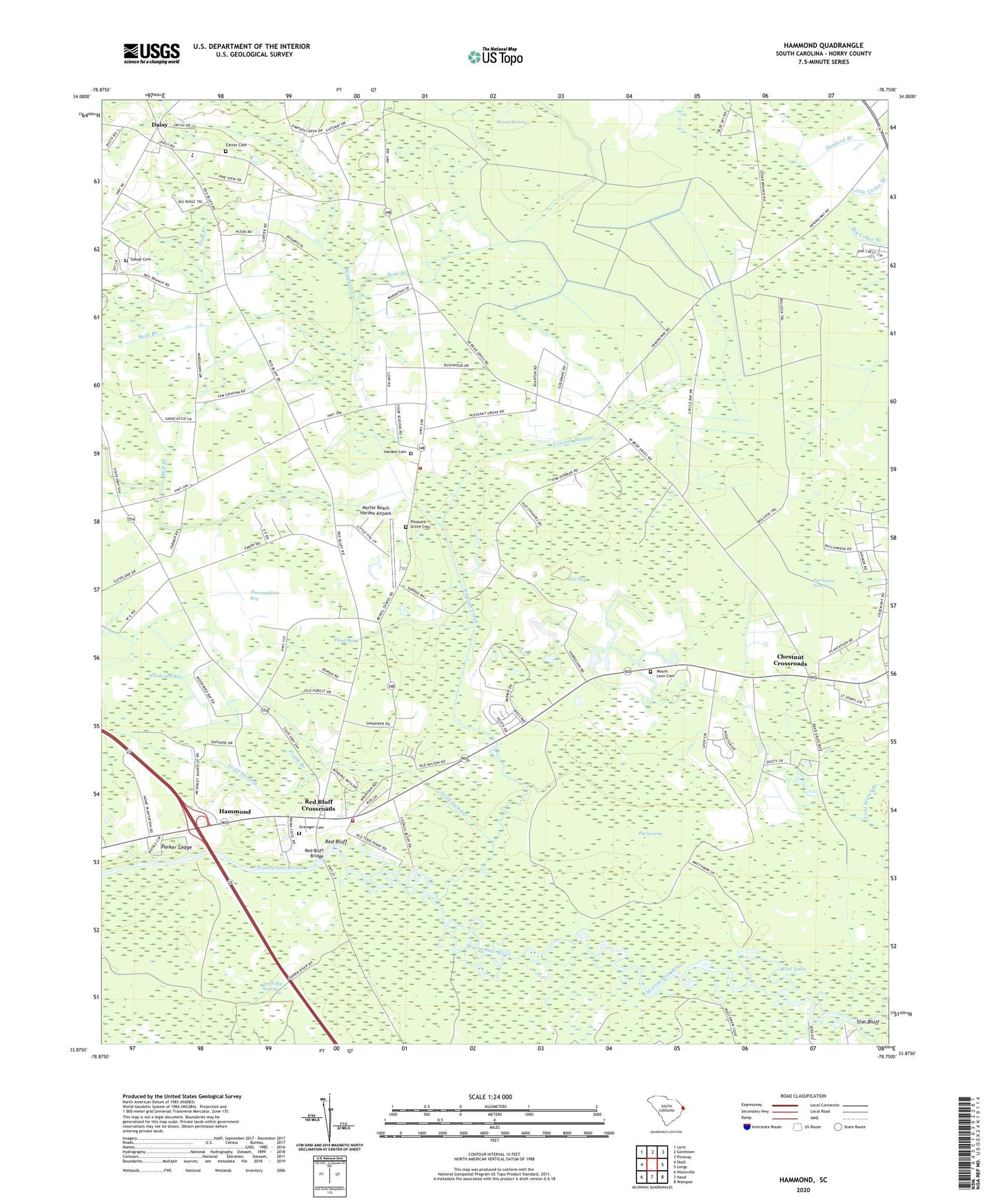
2020 topographic map quadrangle Hammond in the state of South Carolina. Scale: 1:24000. Based on the newly updated USGS 7.5' US Topo map series, this map is in the following counties: Horry. The map contains contour data, water features, and other items you are used to seeing on USGS maps, but also has updated roads and other features. This is the next generation of topographic maps. Printed on high-quality waterproof paper with UV fade-resistant inks.
Quads adjacent to this one:
West: Shell
Northwest: Loris
North: Goretown
Northeast: Pireway
East: Longs
Southeast: Wampee
South: Hand
Southwest: Nixonville
Contains the following named places: Atlantic Coast Medical Transport, Bear Bay School, Bear Branch, Big Savannah Bluff Lake, Burntcane Swamp, Carter Cemetery, Cedar Branch Church, Cedar Branch School, Chestnut Crossroads, Cowpen Swamp, Daisy, Daisy Elementary School, Flat Bay, Flat Lake, Floyd Bay, Frank Branch, Freemont Church, Freemont School, Gause Cemetery, Grainger Cemetery, Hammond, Hardee Cemetery, Horry County Fire Department Mount Vernon, Horry County Fire Department Station 34, Leon Church, Leon School, Live Oak Lake, Long School, Longs Division, Mc Neal Chapel, Mill Branch, Mill Swamp, Mount Leon Cemetery, Mount Vernon Church, Mount Vernon School, Myrtle Beach Hardee Airpark, Neal Branch, Parker Ledge, Pleasant Grove Cemetery, Pleasant Grove Church, Pleasant Hill Church, Red Bluff, Red Bluff Bridge, Red Bluff Crossroads, Red Bluff Ferry, Saint Johns Church, Simpson, Simpson Creek, Simpson Creek Church, Simpson Creek School, Star Bluff, Sweet Home Church, Sweet Home School, Thoroughfare Bay, Todd Swamp, Todd Swamp School, Woodward Bay, ZIP Code: 29568