MyTopo
Pireway North Carolina US Topo Map
Couldn't load pickup availability
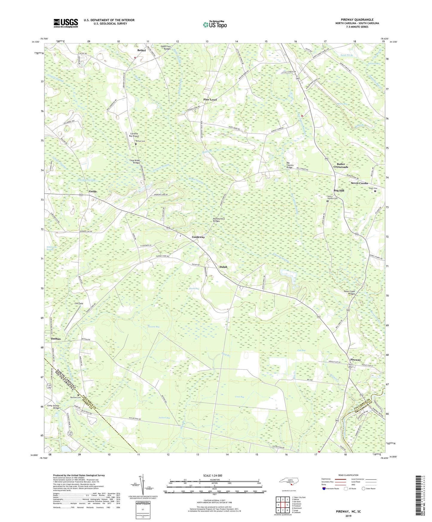
2022 topographic map quadrangle Pireway in the states of North Carolina, South Carolina. Scale: 1:24000. Based on the newly updated USGS 7.5' US Topo map series, this map is in the following counties: Columbus, Horry, Brunswick. The map contains contour data, water features, and other items you are used to seeing on USGS maps, but also has updated roads and other features. This is the next generation of topographic maps. Printed on high-quality waterproof paper with UV fade-resistant inks.
Quads adjacent to this one:
West: Goretown
Northwest: Tabor City East
North: Nakina
Northeast: Old Dock
East: Freeland
Southeast: Calabash
South: Longs
Southwest: Hammond
Contains the following named places: Bethel, Bethel Cemetery, Big Branch, Big Cypress Bridge, Big Cypress Swamp, Briery Bay, Bristol Creek, Bristol Creek Church, Bug Hill, Butler Crossroads, Camp Swamp, Camp Swamp Bridge, Cane Break Bridges, Carolina Bay Airport, Club Bay, Cox Field, Cross Bay, Dothan, Dulah, Dulah Mormon Church, Eddie Ford Bridges, Faith Church, Gores Chapel, Grissett Swamp, Guide, Guideway, Guideway Elementary School, Happy Home Church, Jackson Bay, Jenrette Bay, Juniper Swamp, Maple Branch, Marlowe Cemetery, Marsh Bay, Monie Swamp, Nakina Church, Nakina Fire and Rescue Squad, Nakina Fire and Rescue Squad Pireway, Nakina High School, New Light Church, Old Zion Church, Open Door Church, Pine Level, Pine Level Church, Pireway, Pleasant Union Church, Primitive Church, Ramsey Ford Bridges, Riverside Church, Saint Stevens Cemetery, Sand Pit Branch, Seven Creek Bridges, Seven Creeks, South Williams Volunteer Fire Department Station 25, Stack Cemetery, Township of Bug Hill, Whiskey Swamp, Zion Church, Zion Plain Church, ZIP Code: 28455