MyTopo
Russellville North Carolina US Topo Map
Couldn't load pickup availability
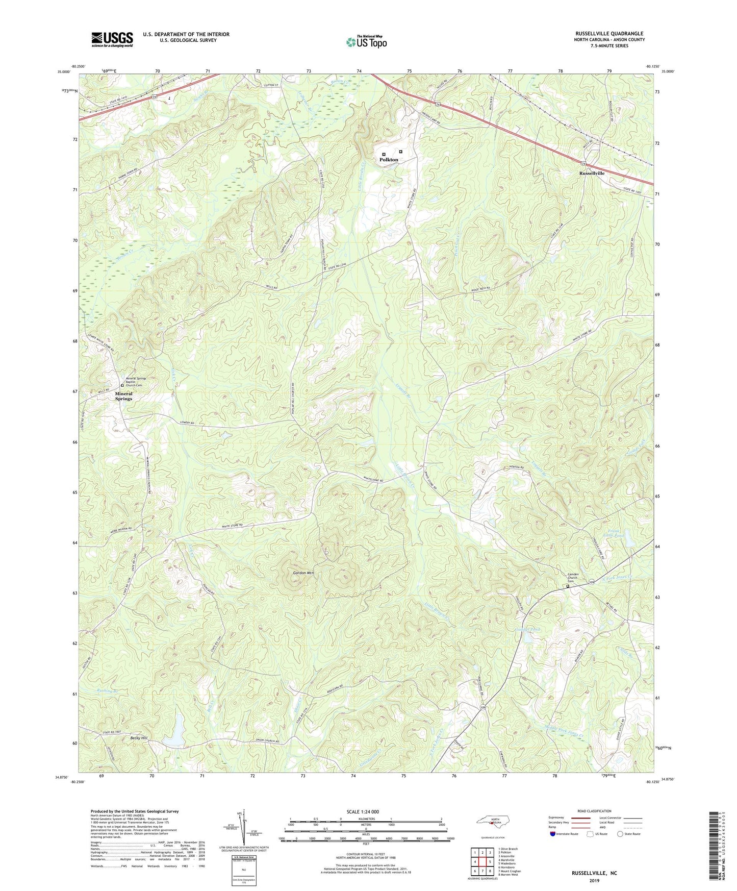
2022 topographic map quadrangle Russellville in the state of North Carolina. Scale: 1:24000. Based on the newly updated USGS 7.5' US Topo map series, this map is in the following counties: Anson. The map contains contour data, water features, and other items you are used to seeing on USGS maps, but also has updated roads and other features. This is the next generation of topographic maps. Printed on high-quality waterproof paper with UV fade-resistant inks.
Quads adjacent to this one:
West: Marshville
Northwest: Olive Branch
North: Polkton
Northeast: Ansonville
East: Wadesboro
Southeast: Morven West
Southwest: Hornsboro
This map covers the same area as the classic USGS quad with code o34080h2.
Contains the following named places: Becky Hill, Brown Creek Correctional Institution, Camden Church, Camden Church Cemetery, Frank Little Pond, Frank Little Pond Dam, Gaddys Pond, Gaddys Pond Dam, Gordon Mountain, Kelly Branch, Lanesboro Correctional Institution, Ledbetter Branch, Leggett Branch, Lick Creek, Mineral Springs, Mineral Springs Baptist Church Cemetery, Mineral Springs Church, New Grove Church, Poplar Hill, Poplar Hill Church, Russellville, Swans Branch, Township of Lanesboro, Travis, Union Church, Unity Chapel, West Rocky Ford Church, White Store Dam, White Store Lake