MyTopo
Spring Island South Carolina US Topo Map
Couldn't load pickup availability
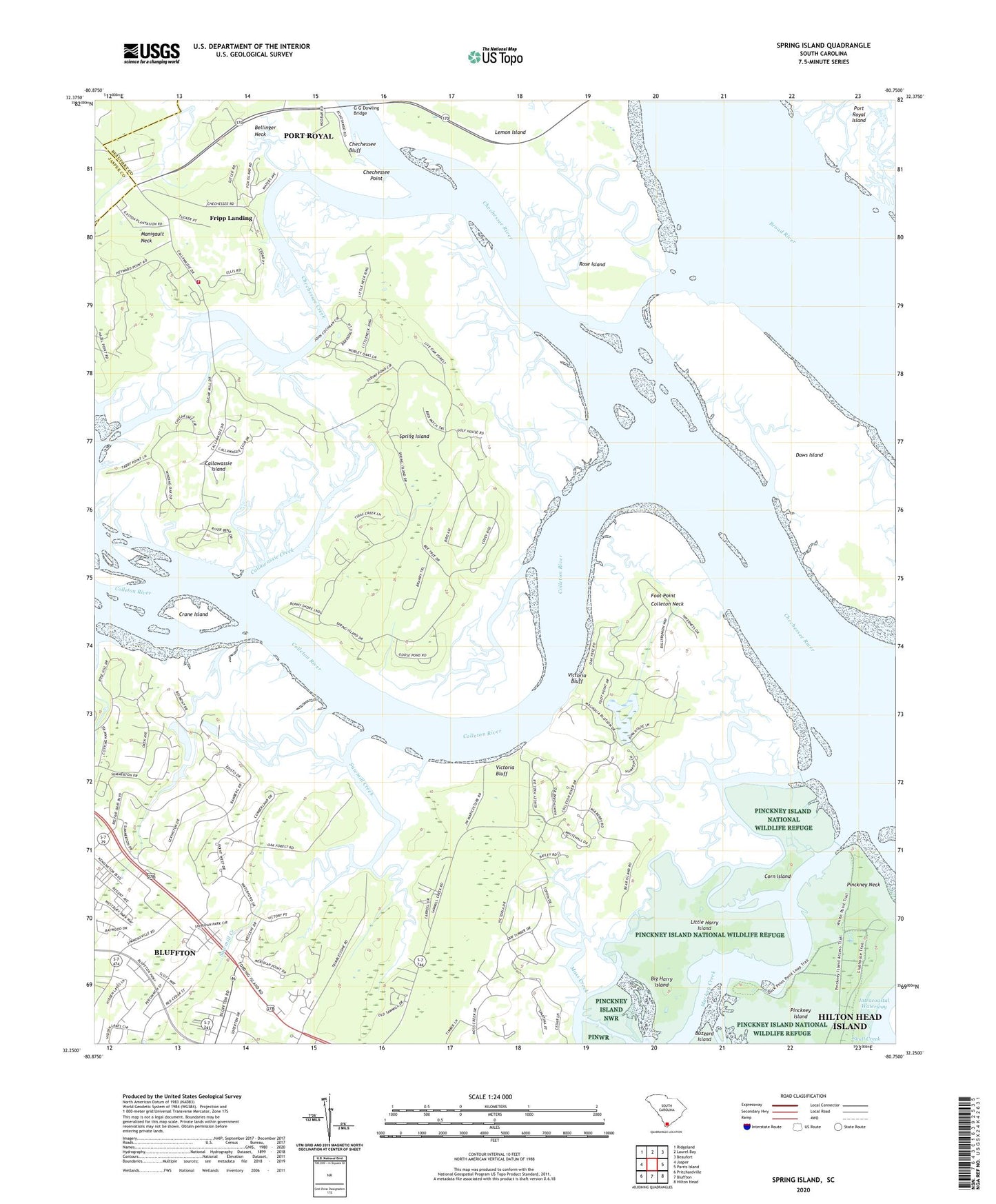
2024 topographic map quadrangle Spring Island in the state of South Carolina. Scale: 1:24000. Based on the newly updated USGS 7.5' US Topo map series, this map is in the following counties: Beaufort, Jasper. The map contains contour data, water features, and other items you are used to seeing on USGS maps, but also has updated roads and other features. This is the next generation of topographic maps. Printed on high-quality waterproof paper with UV fade-resistant inks.
Quads adjacent to this one:
West: Jasper
Northwest: Ridgeland
North: Laurel Bay
Northeast: Beaufort
East: Parris Island
Southeast: Hilton Head
South: Bluffton
Southwest: Pritchardville
This map covers the same area as the classic USGS quad with code o32080c7.
Contains the following named places: Belfair School, Bellinger Neck, Big Harry Island, Bluffton Division, Bluffton Fire Department Chelsea, Callawassie Creek, Callawassie Island, Callawassie Island Club House, Carolina House of Bluffton, Chechessee Creek, Chechessee Point, Cherry Point Wastewater Treatment Plant, Colleton Neck, Colleton River, Copp Landing, Corn Island, Crane Island, Daws Island, Edwards, Foot Point, Foot Point Plantation, Foot Point School, Fripp Landing, G G Dowling Bridge, Hardeeville Church Road Plant, Hog Bluff Plantation, Little Harry Island, Low Country Plaza Shopping Center, Manigault Neck, Marine Railway Pond Dam D-2942, Pinckney Island National Wildlife Refuge, Pinckney Island School, Pinckney Landing, Pinckney Neck, Rose Island, Saint Lukes Church, Sawmill Creek, Shell Point Census Designated Place, South Carolina Noname 07001 Dam Number One D-2940, South Carolina Noname 07001 Dam Number Two D-2941, Spring Island, Spring Island School, Victoria Bluff, Young Zion Church, ZIP Code: 29909