MyTopo
Ninety Six South Carolina US Topo Map
Couldn't load pickup availability
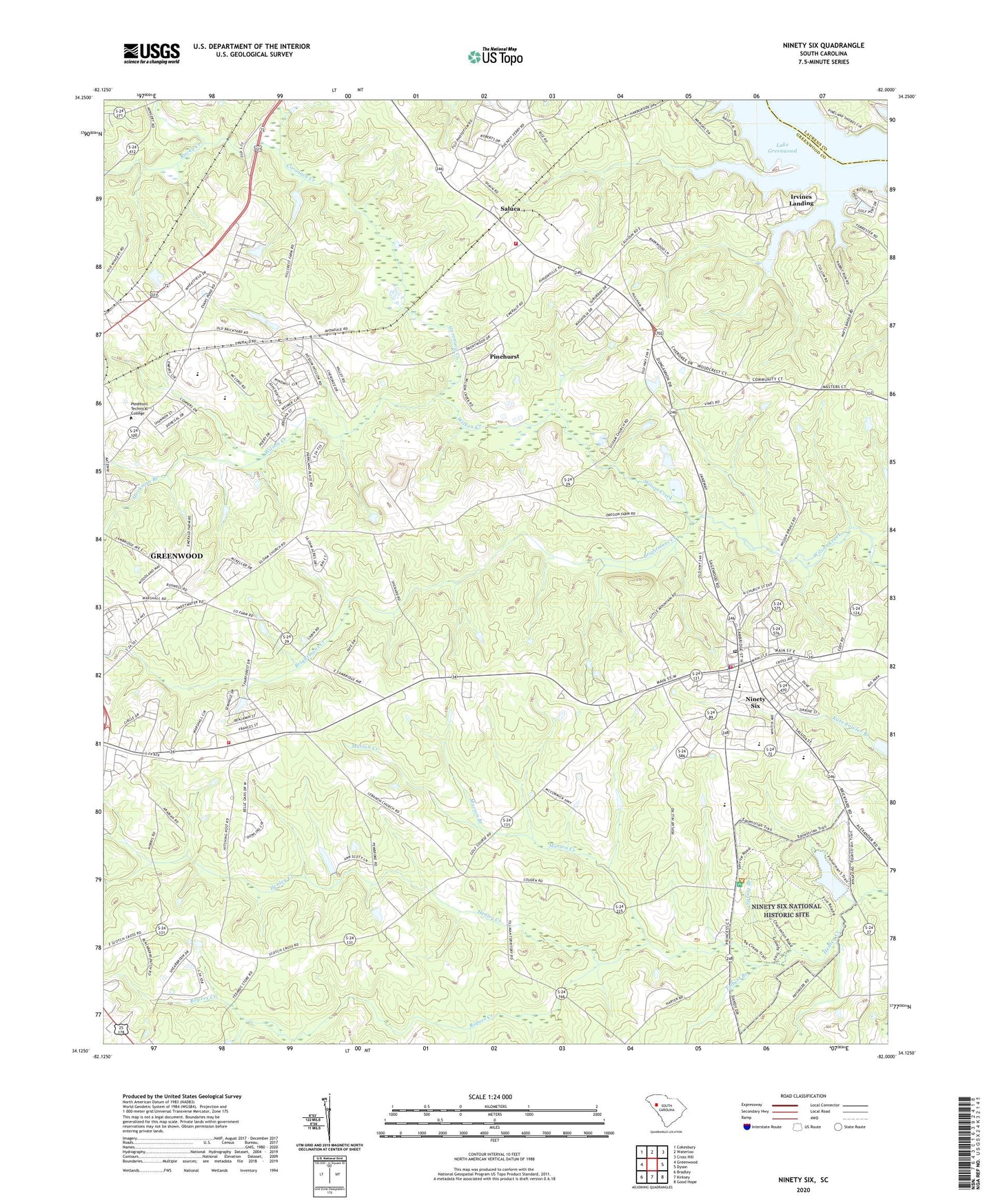
2020 topographic map quadrangle Ninety Six in the state of South Carolina. Scale: 1:24000. Based on the newly updated USGS 7.5' US Topo map series, this map is in the following counties: Greenwood, Laurens. The map contains contour data, water features, and other items you are used to seeing on USGS maps, but also has updated roads and other features. This is the next generation of topographic maps. Printed on high-quality waterproof paper with UV fade-resistant inks.
Quads adjacent to this one:
West: Greenwood
Northwest: Cokesbury
North: Waterloo
Northeast: Cross Hill
East: Dyson
Southeast: Good Hope
South: Kirksey
Southwest: Bradley
Contains the following named places: Aspen Heights, Beechwood, Bethlehem Baptist Church, Brightmans Creek, Calvary School, Cambridge, Cambridge United Methodist Church, Cherry Hill, Colonial Heights, Coronaca Creek, Coronaca Volunteer Fire Department Station 2, Country Homes, Ebenezer Church, Edgewood Middle School, Emerald Place, Fairforest, First Baptist Church of Ninety Six, Forrest Hereford Farm, Friendship Church, Friendship School, Greenwood County Farm, Harbor Heights, Hartzog Acres, Highway 34 Fire Department and Rescue Unit, Irvines Landing, Magnolia Place, Marion Branch, Marion Creek, Marshall Chapel, Marshall Chapel School, Mays United Methodist Church, Mayson Graves, McKellar Farms, Mount Lebanon Church, Mount Lebanon School, Mount Tabor Church, Mount Tabor Church Cemetery, Ninety Six, Ninety Six Church of God, Ninety Six Elementary School, Ninety Six Fire Department Station 80, Ninety Six High School, Ninety Six National Historic Site, Ninety Six Pentecostal Holiness Church, Ninety Six Police Department, Ninety Six Post Office, Old Star Fort, Parkwood, Piedmont Technical College, Pinehurst, Quarry School, Raintree, Rock Presbyterian Church, Rock Presbyterian Church Graveyard, Rocky Creek, Ropers Creek, Saluca, Siloam Church, South Carolina Noname 24003 D-1259 Dam, South Carolina Noname 24005 D-1261 Dam, Spring Branch, Springdale, Springfield Baptist Church Graveyard, Springfield Church, Springfield School, Star Fort Pond, Star Fort Pond Dam, Stockman Branch, Sunset Acres, Temple Church, Tolbert Branch, Town of Ninety Six, Trinity Church, Wheatfield, Woodfields, Woodfields Baptist Church, Youngs Chapel, Youngs Chapel School