MyTopo
Oakwood South Carolina US Topo Map
Couldn't load pickup availability
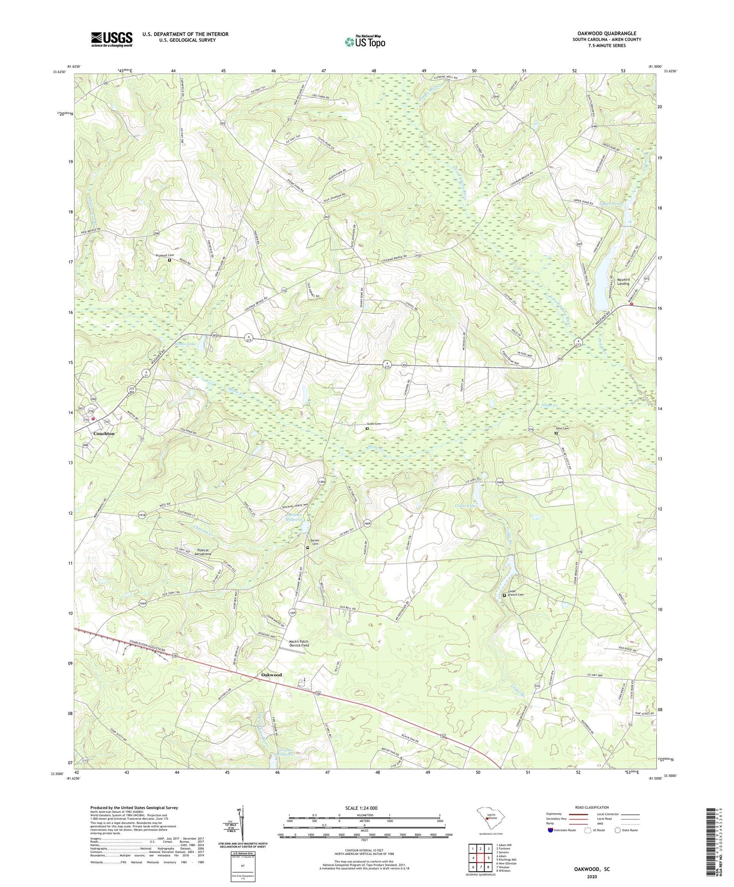
2024 topographic map quadrangle Oakwood in the state of South Carolina. Scale: 1:24000. Based on the newly updated USGS 7.5' US Topo map series, this map is in the following counties: Aiken. The map contains contour data, water features, and other items you are used to seeing on USGS maps, but also has updated roads and other features. This is the next generation of topographic maps. Printed on high-quality waterproof paper with UV fade-resistant inks.
Quads adjacent to this one:
West: Aiken
Northwest: Aiken NW
North: Foxtown
Northeast: Seivern
East: Kitchings Mill
Southeast: Williston
South: Windsor
Southwest: New Ellenton
This map covers the same area as the classic USGS quad with code o33081e5.
Contains the following named places: Apia, Cedar Branch, Cedar Branch Cemetery, Cedar Branch Church, Cedar Creek, Cedar Lake, Cedar Lake School, Chavous Creek, Clarks Mill Creek, Clearwater Branch, Clearwater Branch Church, Couchton, Couchton Fire Department Station 2, Couchton Fire Rescue, Darien Baptist Church, Darien Cemetery, Goss Cemetery, Haden School, Hayden Baptist Church, Hayden Church, Hayden School, Johnson Millpond, Joyce Branch School, Jumping Branch Farm, Livingstons Mill, Mack's Patch-Derrick Field, Mount Hill Memorial Baptist Church, Neeses Lake, Oak Ridge Hunting Preserve Pond, Oakwood, Oakwood Baptist Church, Oakwood School, Oakwood Windsor Elementary School, Ocean Grove Church, Ocean Grove School, Plunkett Cemetery, Polecat Aerodrome, Rock Hill Church, Round Top School, Scott Cemetery, Scotts Lake, Shaw Creek, Shaw Fork School, Shaws Fork Baptist Church, Shaws Fork School, South Carolina Noname 02010 D-1994 Dam, South Carolina Noname 02037 D-2028 Dam, South Carolina Noname 02060 D-2013 Dam, South Carolina Noname 02082 D-2019 Dam, Tarrants Millpond, Upper Pond, Upper Pond Dam D-2027