MyTopo
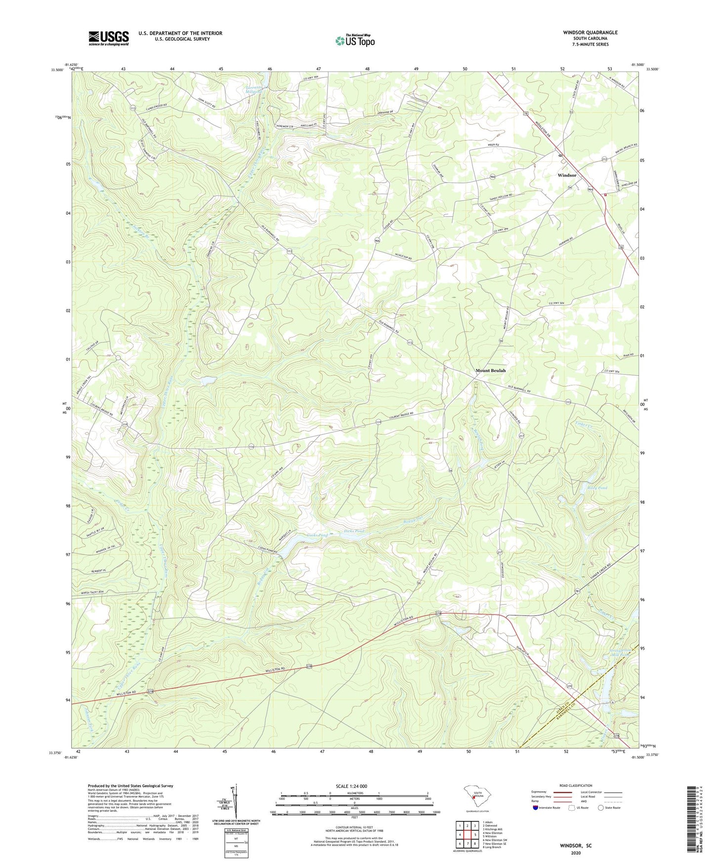
Windsor South Carolina US Topo Map
Couldn't load pickup availability
Also explore the Windsor Forest Service Topo of this same quad for updated USFS data
2024 topographic map quadrangle Windsor in the state of South Carolina. Scale: 1:24000. Based on the newly updated USGS 7.5' US Topo map series, this map is in the following counties: Aiken, Barnwell. The map contains contour data, water features, and other items you are used to seeing on USGS maps, but also has updated roads and other features. This is the next generation of topographic maps. Printed on high-quality waterproof paper with UV fade-resistant inks.
Quads adjacent to this one:
West: New Ellenton
Northwest: Aiken
North: Oakwood
Northeast: Kitchings Mill
East: Williston
Southeast: Long Branch
South: New Ellenton SE
Southwest: New Ellenton SW
This map covers the same area as the classic USGS quad with code o33081d5.
Contains the following named places: Beulah Fork, Beulah Grove Church, Beulah Grove School, Boggy Gut, Cedar Creek, Cooks Pond, Dicks Pond, First Baptist Church of Windsor, Gum Ridge School, Hickory Grove School, Hillcrest Church, Jackson Branch, Johnson Fork, Mixon Pond Dam D-3051, Mount Beulah, Mount Beulah Baptist Church, Mount Beulah School, Old Rosemary Baptist Church, Riley Pond, Rosemary School, South Carolina Noname 02053 Dam, South Carolina Noname 02083 D-2020 Dam, South Carolina Noname 02084 D-2040 Dam, Stringfellow Mill Pond, Stringfellows Mill, Town of Windsor, Union Branch Church, WAAW-FM (Williston), Windsor, Windsor Division, Windsor Elementary School, Windsor Fire - Rescue Department, Wolfpit School, ZIP Code: 29856