MyTopo
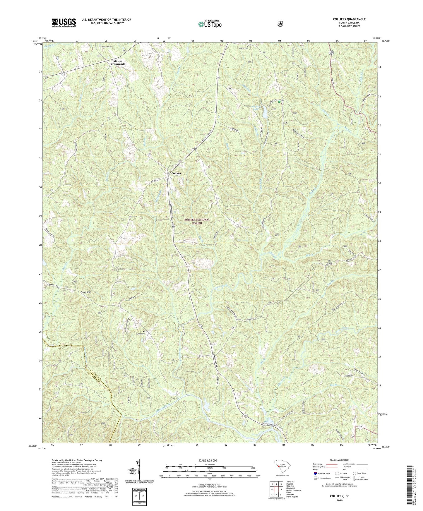
Colliers South Carolina US Topo Map
Couldn't load pickup availability
Also explore the Colliers Forest Service Topo of this same quad for updated USFS data
2024 topographic map quadrangle Colliers in the state of South Carolina. Scale: 1:24000. Based on the newly updated USGS 7.5' US Topo map series, this map is in the following counties: Edgefield, McCormick. The map contains contour data, water features, and other items you are used to seeing on USGS maps, but also has updated roads and other features. This is the next generation of topographic maps. Printed on high-quality waterproof paper with UV fade-resistant inks.
Quads adjacent to this one:
West: Clarks Hill
Northwest: Parksville
North: Red Hill
Northeast: Edgefield
East: Ropers Crossroads
Southeast: North Augusta
South: Martinez
Southwest: Evans
This map covers the same area as the classic USGS quad with code o33082f1.
Contains the following named places: Big Branch, Big Creek, Briggs Quarter School, Carey Hill, Carey Hill Church, Carey Hill School, Cedar Branch School, Cedar Creek, Cheves Creek, Colliers, Colliers Church, Colliers School, Dry Branch, Dry Creek, Horn Creek, Horn Creek Hiking Trail, Lick Fork, Lick Fork Campground, Lick Fork Lake, Lick Fork Lake Dam D-0875, Martin Cemetery, McKie Cemetery, Miller Branch, Millers Crossroads, Mount Olive Church, Mount Olive School, Mount Zion Church, Owl Branch, Pine Grove School, Piney Grove Church, Poplar Spring Church, Prescott Cemetery, Reedy Branch, Republican Church, Rock Creek, Southeast Edgefield Division, Wall Pond Dam D-1691, Williams Branch, ZIP Code: 29821