MyTopo
Red Hill South Carolina US Topo Map
Couldn't load pickup availability
Also explore the Red Hill Forest Service Topo of this same quad for updated USFS data
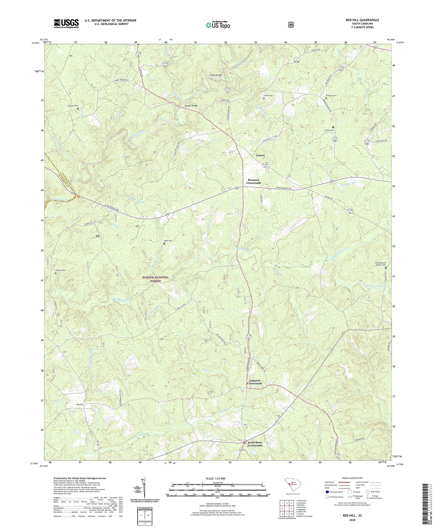
2024 topographic map quadrangle Red Hill in the state of South Carolina. Scale: 1:24000. Based on the newly updated USGS 7.5' US Topo map series, this map is in the following counties: Edgefield, McCormick. The map contains contour data, water features, and other items you are used to seeing on USGS maps, but also has updated roads and other features. This is the next generation of topographic maps. Printed on high-quality waterproof paper with UV fade-resistant inks.
Quads adjacent to this one:
West: Parksville
Northwest: Winterseat
North: Limestone
Northeast: Owdoms
East: Edgefield
Southeast: Ropers Crossroads
South: Colliers
Southwest: Clarks Hill
This map covers the same area as the classic USGS quad with code o33082g1.
Contains the following named places: Antioch, Antioch Church, Antioch School, Bailey Branch, Barrs Chapel, Berea Church, Broadwater Branch, Brunson Crossroads, Brunson School, Brunson-Cleora Community Center, Camp Branch, Cartledge School, Cedar Grove Church, Chap Branch, China Grove Church, China Grove School, Cleora, Cochran Cemetery, Cockran Church, Cold Springs School, Collier School, Corley Cemetery, Crooked Run, Cyper Creek, Dunn Creek, Edgefield Division, Gilgal Bridge, Griffis Cemetery, Hammond Grove School, Hollingsworth - Walker Cemetery, Holmes Cemetery, Horse Branch, Johnson Crossroads, Liberty Spring School, Little Beaverdam Creek, Mathis Pond Dam D-1692, Moores Church, Moores School, Morgan Bridge, Moss Branch, Moss Cemetery, Moultries Mill, Oak Grove School, Pike Branch, Pressley Cemetery, Red Hill, Red Hill Baptist Church, Red Hill School, Red Hill Spring Branch, Robinson School, Rocky Creek, Shady Grove Church, Wash School, West Side Community Center, West Store Crossroads, Westside Volunteer Fire Department, White Branch