MyTopo
Ridgeway South Carolina US Topo Map
Couldn't load pickup availability
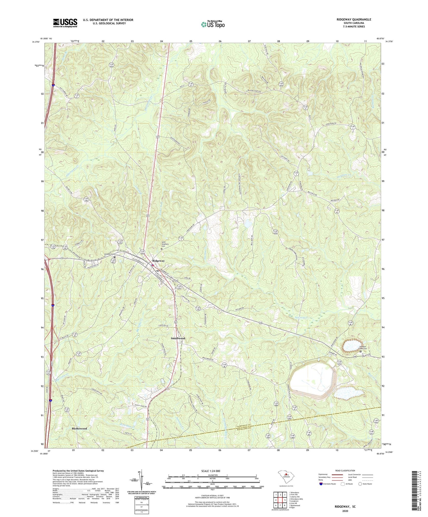
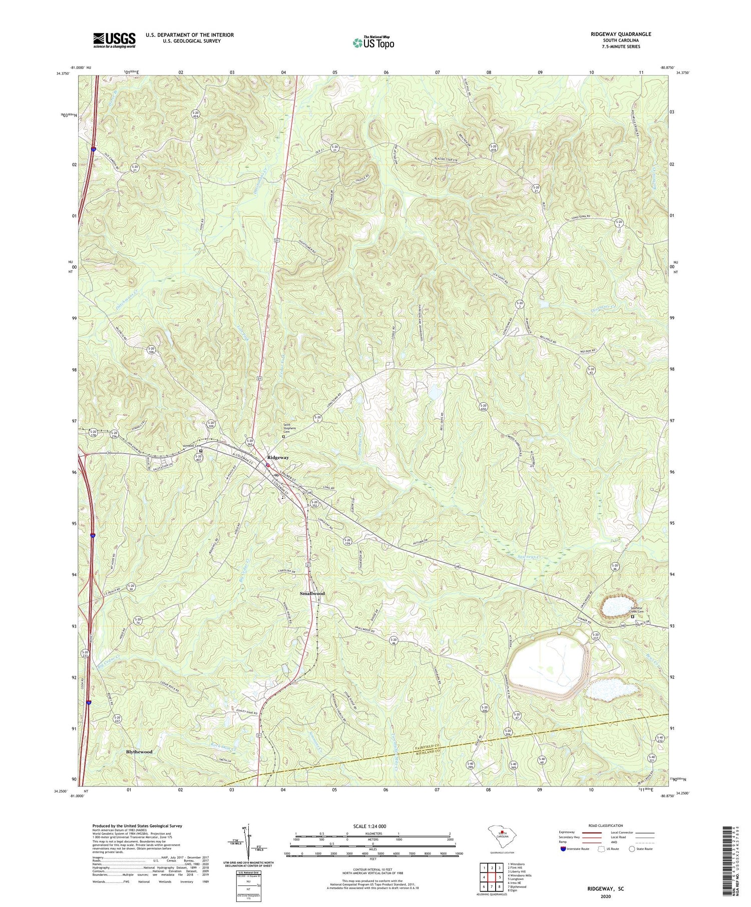
2020 topographic map quadrangle Ridgeway in the state of South Carolina. Scale: 1:24000. Based on the newly updated USGS 7.5' US Topo map series, this map is in the following counties: Fairfield, Richland. The map contains contour data, water features, and other items you are used to seeing on USGS maps, but also has updated roads and other features. This is the next generation of topographic maps. Printed on high-quality waterproof paper with UV fade-resistant inks.
Quads adjacent to this one:
West: Winnsboro Mills
Northwest: Winnsboro
North: Flint Hill
Northeast: Liberty Hill
East: Longtown
Southeast: Elgin
South: Blythewood
Southwest: Irmo NE
Contains the following named places: Aimwell Cemetery, Brown Pond Dam D-1591, Cedar Fork, Fairfield County Fire Department Ridgeway, Geiger School, Good Hope Church, Lots Fork, Macedonia Church, Mount Pisgah Church, Oak Grove Church, Oak Grove School, Rehoboth Church, Ridgeway, Ridgeway Division, Ridgeway Historic District, Ridgeway Police Department, Rulis Chapel, Saint Stephens Cemetery, Saint Stephens Church, Sawneys Creek Cemetery, Sawneys Creek Church, Smallwood, South Carolina Noname 20023 D-0533 Dam, Town of Ridgeway, ZIP Code: 29130