MyTopo
Lowrys South Carolina US Topo Map
Couldn't load pickup availability
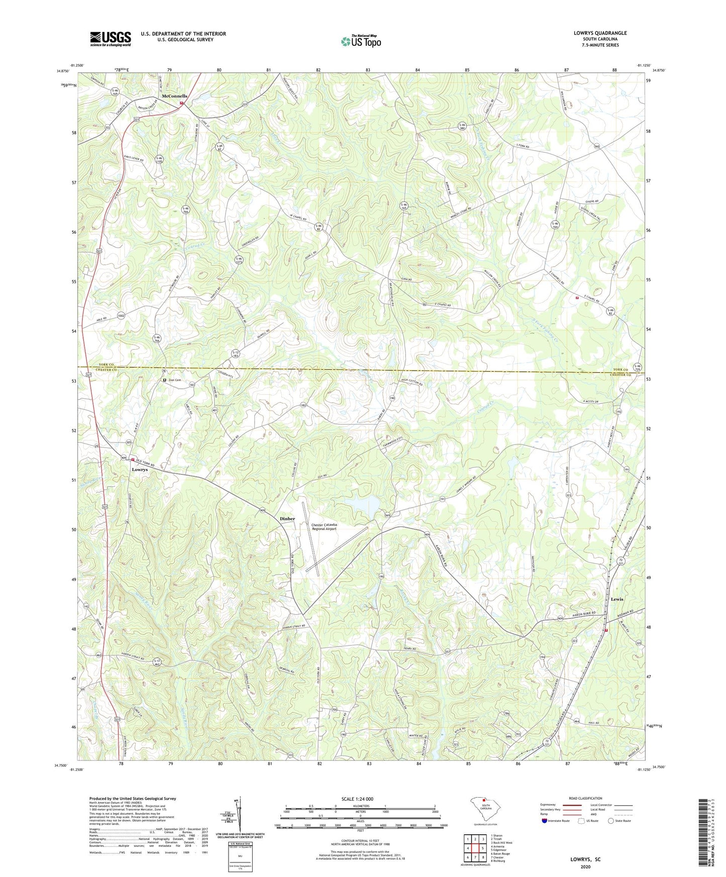
2024 topographic map quadrangle Lowrys in the state of South Carolina. Scale: 1:24000. Based on the newly updated USGS 7.5' US Topo map series, this map is in the following counties: Chester, York. The map contains contour data, water features, and other items you are used to seeing on USGS maps, but also has updated roads and other features. This is the next generation of topographic maps. Printed on high-quality waterproof paper with UV fade-resistant inks.
Quads adjacent to this one:
West: Armenia
Northwest: Sharon
North: Tirzah
Northeast: Rock Hill West
East: Edgemoor
Southeast: Richburg
South: Chester
Southwest: Baton Rouge
This map covers the same area as the classic USGS quad with code o34081g2.
Contains the following named places: Aycock Pond Dam D-3667, Brattonsville, Brattonsville Historic District, Browns Chapel, Caper Chapel, Capers Chapel School, Chester Catawba Regional Airport, Chestnut Grove Church, Chestnut Grove School, Christian Home Church, Christian Home School, Conrad Creek, Dinber, Gethsemane Baptist Church, Hermit Hill Farm, Lewis, Lewis Fire Department Lewis, Logans Pond D-1439 Dam, Love Creek, Lowrys, Lowrys Baptist Church, Lowryville School, McConnells, McConnells Fire Department, Mount Dowell Baptist Church, New Home Rosenwald School, New Zion Church, New Zion Community Center, North Chester Fire Department, Oakdale Fire Department Station 3, Rosenwald School, Saint Paul Church, Saint Paul School, Sloan Farms, South Carolina Noname 12003 D-0217 Dam, South Carolina Noname 12024 D-0219 Dam, South Carolina Noname 46024 D-3672 Dam, Town of Lowrys, Town of McConnells, Uriel Church, Williams School, Zion Cemetery, Zion Presbyterian Church, ZIP Code: 29726