MyTopo
Springfield South Carolina US Topo Map
Couldn't load pickup availability
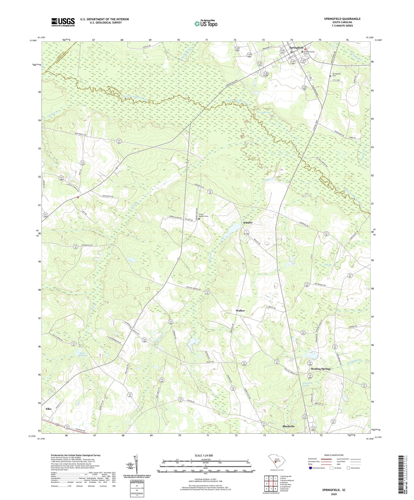
2020 topographic map quadrangle Springfield in the state of South Carolina. Scale: 1:24000. Based on the newly updated USGS 7.5' US Topo map series, this map is in the following counties: Barnwell, Orangeburg, Aiken. The map contains contour data, water features, and other items you are used to seeing on USGS maps, but also has updated roads and other features. This is the next generation of topographic maps. Printed on high-quality waterproof paper with UV fade-resistant inks.
Quads adjacent to this one:
West: Williston
Northwest: Kitchings Mill
North: Salley
Northeast: Harleys Millpond
East: Norway West
Southeast: Denmark
South: Blackville
Southwest: Long Branch
Contains the following named places: Bolens Pond D-3055 Dam, Boylston Mill, Brodie Family Cemetery, Calvary Church, Calvary School, Cowford Lake, Dean Swamp Creek, Dry Branch School, Ebenezer Baptist Church, Ebenezer School, Foster Branch Church, Frost Branch Baptist Church, Frost Branch Cemetery, Frost Branch School, Healing Spring School, Healing Springs, Healing Springs Baptist Church, Matthews Mill Pond D-3049 Dam, Matthews Millpond, Mount Calvary Church, Pilgrim Rest Baptist Church, Pine Hill Church, Redds Pond D-3050 Dam, Reese Creek School, Saint Matthews School, Saint Stephens Church, Springfield, Springfield Cemetery, Springfield Elementary School, Springfield Fire Department, Springfield Post Office, Spur Branch, Stills Pond D-3057 Dam, Town of Springfield, W C Smiths Pond D-3070 Dam, Walker, Whaley, Whaley Creek, Willis Mill, Willis Mill Pond D-3054 Dam, Willis Millpond, Williston Fire Department, Yarrow Branch, Yaw Branch School, ZIP Code: 29826