MyTopo
Fruitdale South Dakota US Topo Map
Couldn't load pickup availability
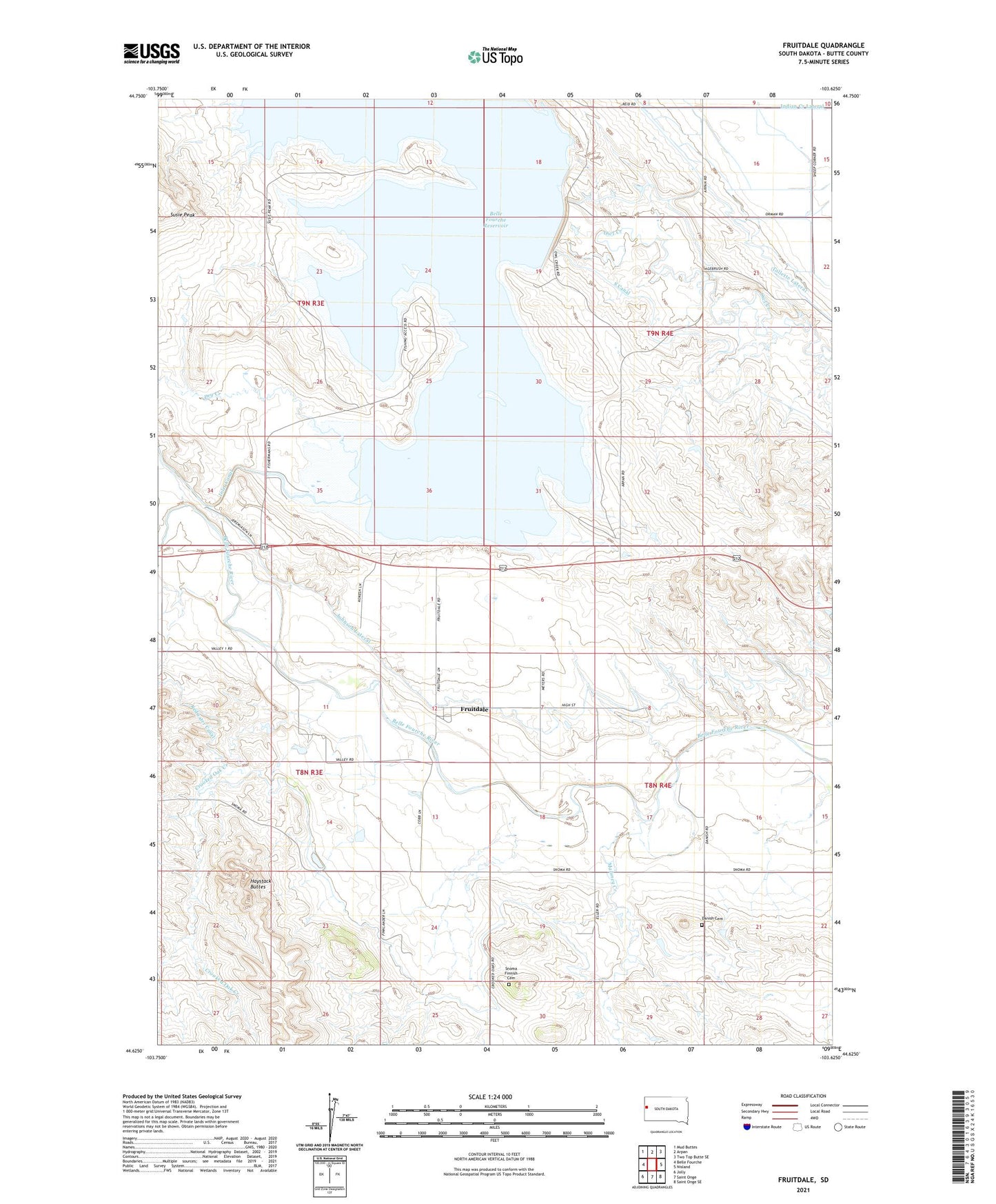
2021 topographic map quadrangle Fruitdale in the state of South Dakota. Scale: 1:24000. Based on the newly updated USGS 7.5' US Topo map series, this map is in the following counties: Butte. The map contains contour data, water features, and other items you are used to seeing on USGS maps, but also has updated roads and other features. This is the next generation of topographic maps. Printed on high-quality waterproof paper with UV fade-resistant inks.
Quads adjacent to this one:
West: Belle Fourche
Northwest: Mud Buttes
North: Arpan
Northeast: Two Top Butte SE
East: Nisland
Southeast: Saint Onge SE
South: Saint Onge
Southwest: Jolly
This map covers the same area as the classic USGS quad with code o44103f6.
Contains the following named places: Belle Fourche Dam, Belle Fourche National Wildlife Refuge, Belle Fourche Reservoir, Crooked Oak Creek, Danish Cemetery, Dry Creek, Flowing Well, Fruitdale, George Merickson Dam Number 1, Haystack Buttes, Johnson Lateral, Maloney Creek, Orman Dam, Orman School, Snoma, Snoma Finnish Cemetery, Snoma School, Susie Peak, Town of Fruitdale