MyTopo
Artesian South Dakota US Topo Map
Couldn't load pickup availability
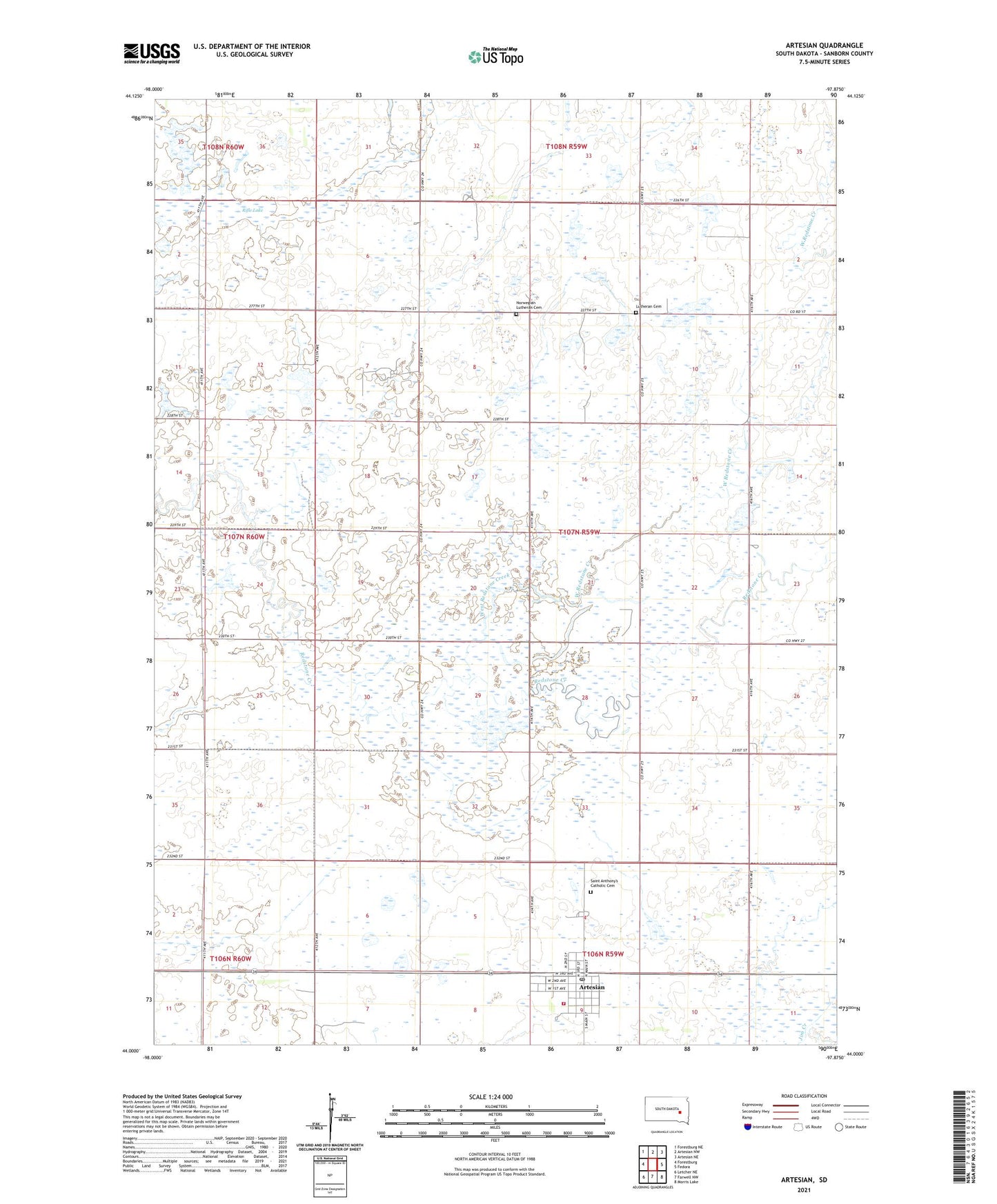
2021 topographic map quadrangle Artesian in the state of South Dakota. Scale: 1:24000. Based on the newly updated USGS 7.5' US Topo map series, this map is in the following counties: Sanborn. The map contains contour data, water features, and other items you are used to seeing on USGS maps, but also has updated roads and other features. This is the next generation of topographic maps. Printed on high-quality waterproof paper with UV fade-resistant inks.
Quads adjacent to this one:
West: Forestburg
Northwest: Forestburg NE
North: Artesian NW
Northeast: Artesian NE
East: Fedora
Southeast: Morris Lake
South: Farwell NW
Southwest: Letcher NE
This map covers the same area as the classic USGS quad with code o44097a8.
Contains the following named places: Artesian, Artesian Community Center, Artesian Post Office, Artesian Presbyterian Church, Artesian Volunteer Fire Department, Artesian Wesleyan Methodist Church, Callihan, Denton, Diana Cemetery, Lutheran Cemetery, Norwegian Lutheran Cemetery, Oneida Township Hall, Rifle Lake, Roberts School, Saint Anthony's Catholic Cemetery, Shaffer School, Town of Artesian, Township of Benedict, Tysdal School, West Redstone Creek, Wiso School, ZIP Code: 57314