MyTopo
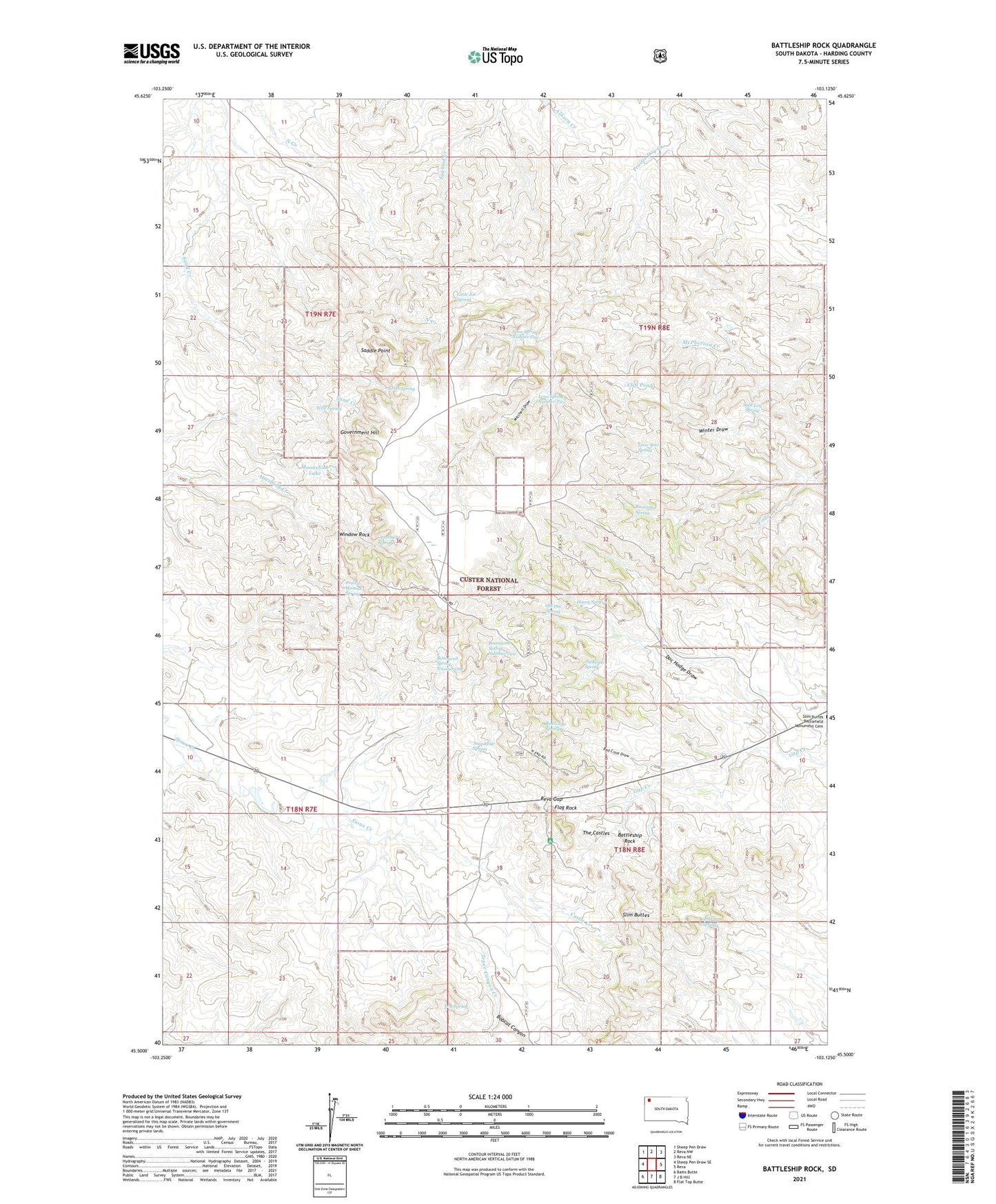
Battleship Rock South Dakota US Topo Map
Couldn't load pickup availability
Also explore the Battleship Rock Forest Service Topo of this same quad for updated USFS data
2021 topographic map quadrangle Battleship Rock in the state of South Dakota. Scale: 1:24000. Based on the newly updated USGS 7.5' US Topo map series, this map is in the following counties: Harding. The map contains contour data, water features, and other items you are used to seeing on USGS maps, but also has updated roads and other features. This is the next generation of topographic maps. Printed on high-quality waterproof paper with UV fade-resistant inks.
Quads adjacent to this one:
West: Sheep Pen Draw SE
Northwest: Sheep Pen Draw
North: Reva NW
Northeast: Reva NE
East: Reva
Southeast: Flat Top Butte
South: J B Hill
Southwest: Bams Butte
This map covers the same area as the classic USGS quad with code o45103e2.
Contains the following named places: Atterbury Spring, Battleship Rock, Bobcat Canyon, Bonniwell Spring Number One, Bonniwell Spring Number Two, Castle Creek, Cliff Pond, Doc Hodge Draw, Flag Rock, Government Hill, Harry Spring, Helms Ranch, Ivers Mine, Lena Spring Number One, Lena Spring Number Two, Lermeny Ranch, Little Joe Spring, Log Spring, Lone Tree Spring, Mitchell Draw, Moonshine Lake, North Spring, Old Doc Spring, Olson Ranch, Prairie Woman Spring, Puckeroo Spring, Red Cross Draw, Red Cross Spring, Reva, Reva Campground, Reva Gap, Running Spring, Saddle Point, Soap Hole Spring, Split Log Spring, Tepee Canyon Creek, The Castles, Thybo Well, Verhulst Spring, West Spring, Window Rock