MyTopo
Howard South Dakota US Topo Map
Couldn't load pickup availability
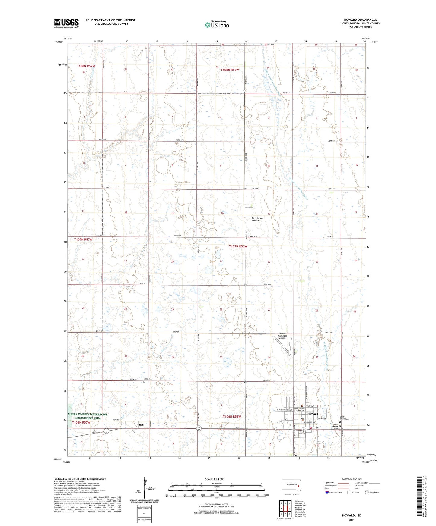
2021 topographic map quadrangle Howard in the state of South Dakota. Scale: 1:24000. Based on the newly updated USGS 7.5' US Topo map series, this map is in the following counties: Miner. The map contains contour data, water features, and other items you are used to seeing on USGS maps, but also has updated roads and other features. This is the next generation of topographic maps. Printed on high-quality waterproof paper with UV fade-resistant inks.
Quads adjacent to this one:
West: Roswell
Northwest: Carthage
North: Howard NE
Northeast: Oldham NW
East: Oldham SW
Southeast: Canova East
South: Canova West
Southwest: Bitter Lake
This map covers the same area as the classic USGS quad with code o44097a5.
Contains the following named places: City of Howard, Graceland Cemetery, Howard, Howard City Hall, Howard Elementary School, Howard Fire Department, Howard High School, Howard Junior High School, Howard Municipal Airport, Howard Post Office, Howard Public Library, IOOF Cemetery, Miner County, Miner County Ambulance Service, Miner County Courthouse, Miner County Rural Life Museum, Miner County Sheriff's Office, Saint John's Cemetery, Saint Joseph's Cemetery, Town of Vilas, Township of Adams, Township of Howard, Vilas, ZIP Code: 57349