MyTopo
Cicero Peak South Dakota US Topo Map
Couldn't load pickup availability
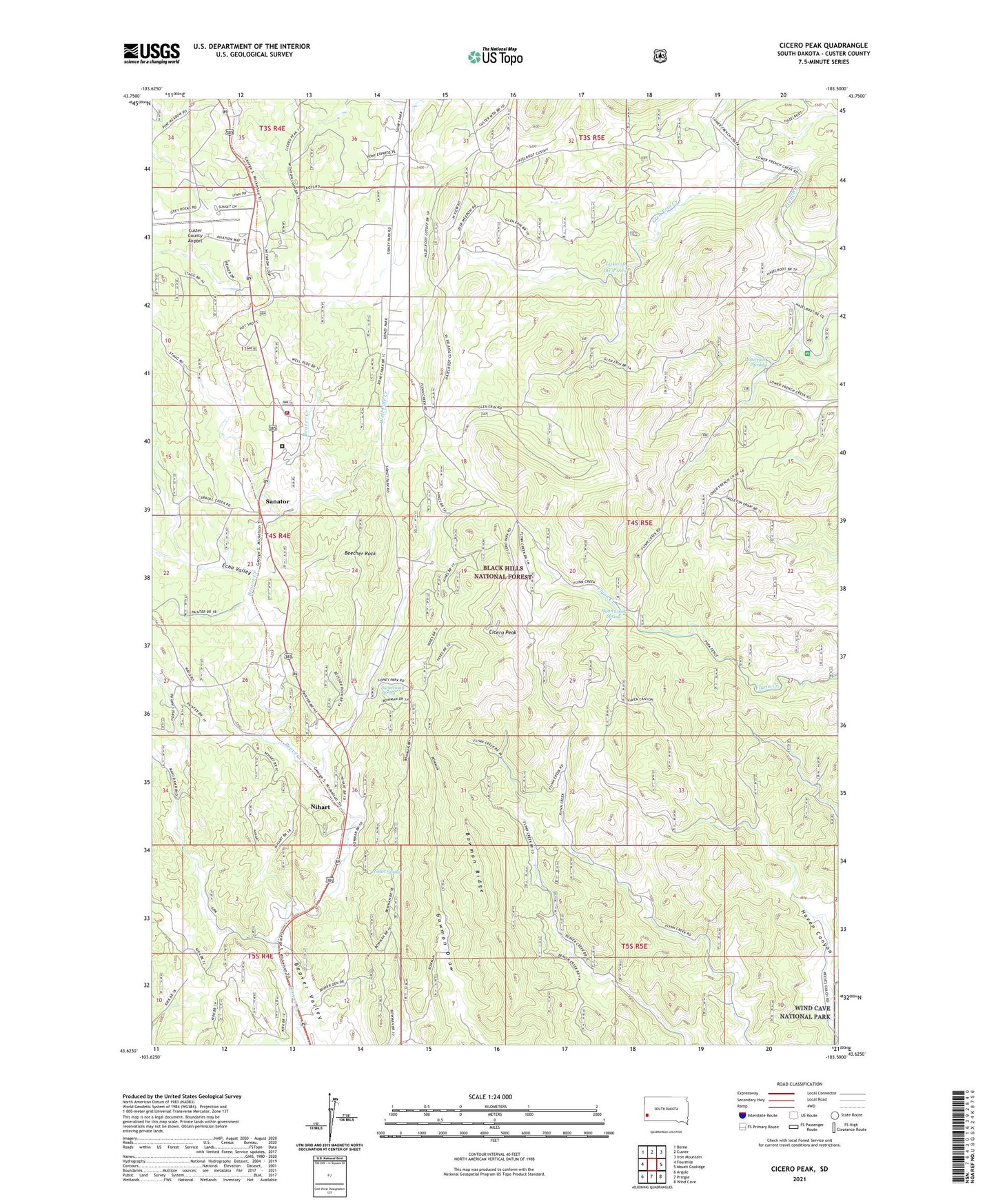
2021 topographic map quadrangle Cicero Peak in the state of South Dakota. Scale: 1:24000. Based on the newly updated USGS 7.5' US Topo map series, this map is in the following counties: Custer. The map contains contour data, water features, and other items you are used to seeing on USGS maps, but also has updated roads and other features. This is the next generation of topographic maps. Printed on high-quality waterproof paper with UV fade-resistant inks.
Quads adjacent to this one:
West: Fourmile
Northwest: Berne
North: Custer
Northeast: Iron Mountain
East: Mount Coolidge
Southeast: Wind Cave
South: Pringle
Southwest: Argyle
Contains the following named places: Bare Top Number 2 Lode Mine, Beck Lode Mine, Beecher Number Two Mine, Beecher Rock, Bowman Ridge, Bull Moose Lode Mine, Burgess Mica Prospect Mine, Burt Mica Mine, Cicero Peak, Custer County Airport, Echo Valley, Evergreen School, Flora Lode Mine, Flynn Creek Picnic Area, Flynn Creek Spring, Gladys Nells Mine, Glen Erin Creek, Gray Rocks, Haselrodt Spring, Haven Canyon, Hazelrodt Picnic Area, Hazelrodt Summer Homes, Heidepriem and Cattles Mine, Hot Shot Mine, Lake of the Pines, Lee Burrows Dike Mine, Linwood Mine, Lucky Spar Lode Mine, Lucky Star Prospect Mine, Lucky Strike Mine, Mayo, Mayo School, McCurran Ranch, Mica King Mine, Mica King Number 3 Claim Mine, Mitchell Number 1 Lode Mine, Nihart, Nihart Spring, Rambler Lode Mine, Rose Quartz Mine, Saint Louis Mine, Sanator, Sidney Creek, Sonny Boy Lode Mine, Star and Blue Bonnet Claims Mine, STAR Evergreen High School, STAR Evergreen Junior High School, Sutherland Ranch, Sutherland Spring, Tanner Ranch, Tinsley Mine, Triangle A Mine, United States Forest Service Tatanka Hotshots, Ventling Ranch, Warren Ranch, Wayside Lode Mine, Well Pole Creek, White Elephant Mine, Winters Ranch