MyTopo
Crooks South Dakota US Topo Map
Couldn't load pickup availability
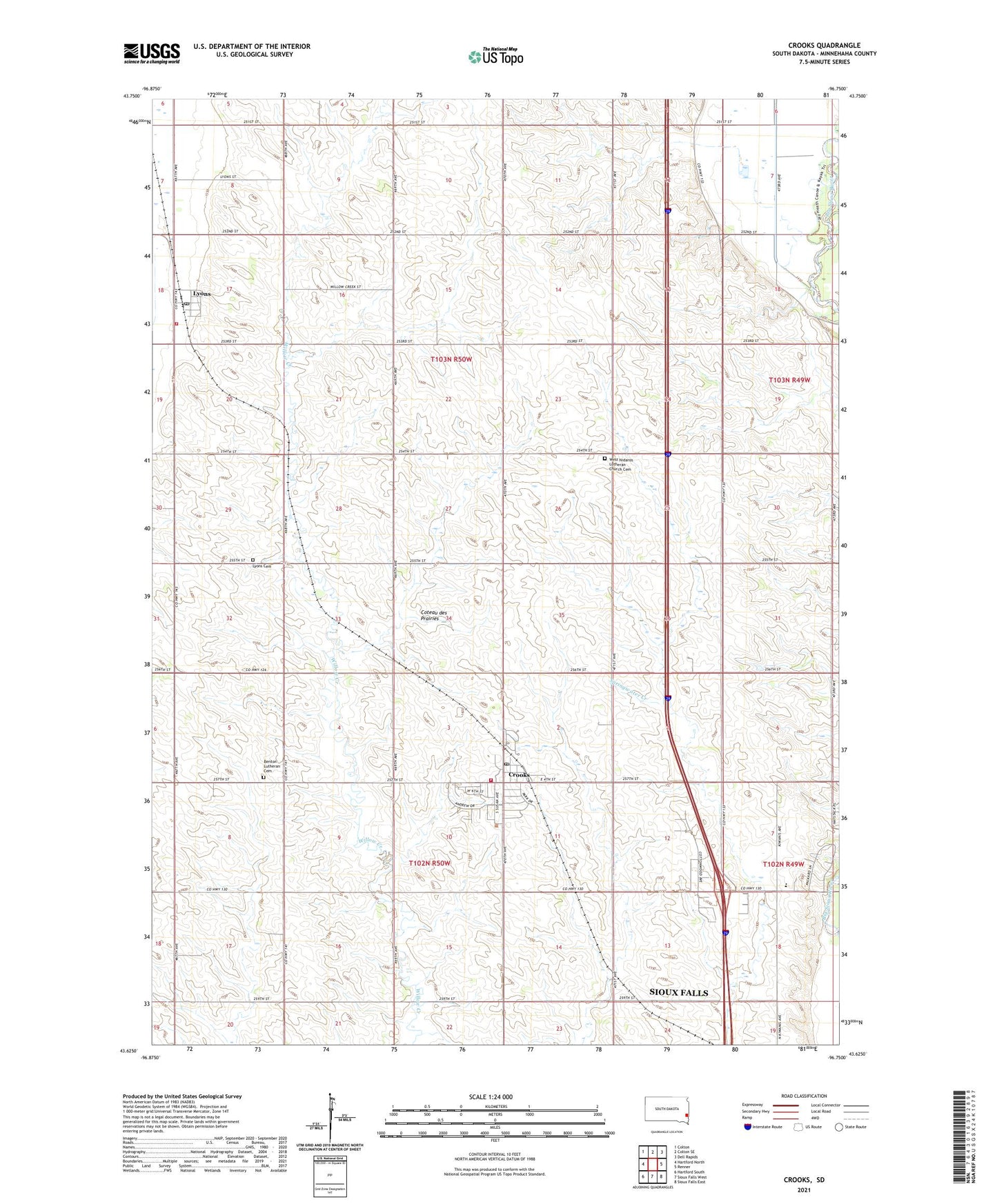
2021 topographic map quadrangle Crooks in the state of South Dakota. Scale: 1:24000. Based on the newly updated USGS 7.5' US Topo map series, this map is in the following counties: Minnehaha. The map contains contour data, water features, and other items you are used to seeing on USGS maps, but also has updated roads and other features. This is the next generation of topographic maps. Printed on high-quality waterproof paper with UV fade-resistant inks.
Quads adjacent to this one:
West: Hartford North
Northwest: Colton
North: Colton SE
Northeast: Dell Rapids
East: Renner
Southeast: Sioux Falls East
South: Sioux Falls West
Southwest: Hartford South
This map covers the same area as the classic USGS quad with code o43096f7.
Contains the following named places: Benton Church, Benton Lutheran Cemetery, City of Crooks, Crooks, Crooks Branch Library, Crooks Municipal Office, Crooks Post Office, Crooks Volunteer Fire Department, Johnsons Addition, Lyons, Lyons Cemetery, Lyons Census Designated Place, Lyons Post Office, Lyons Volunteer Fire Department, Minnehaha County, Morefield, New Hope, Renberg Elementary School, Township of Benton, Township of Lyons, West Nidaros Church, West Nidaros Lutheran Church Cemetery, West Point, ZIP Codes: 57003, 57020, 57041