MyTopo
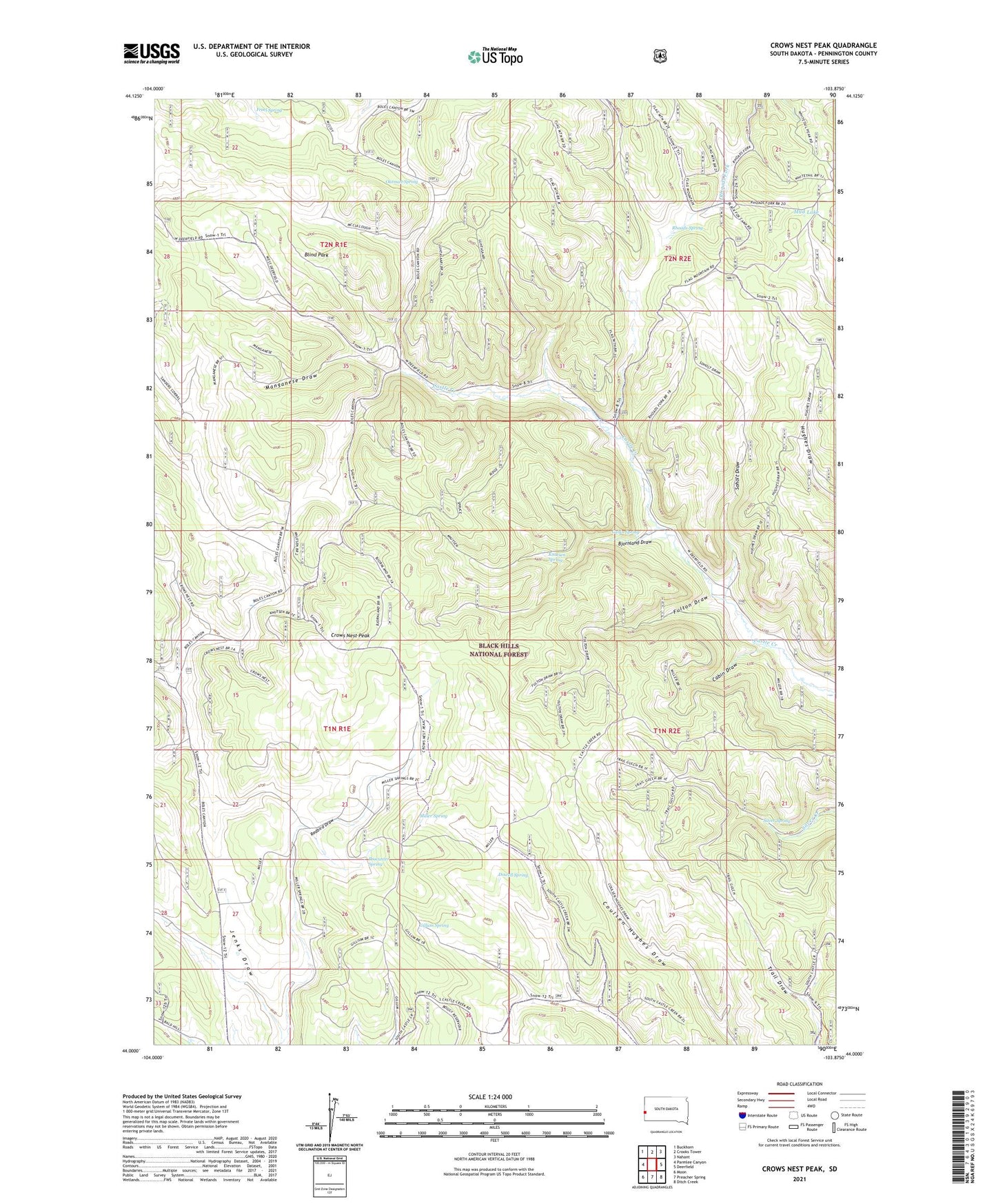
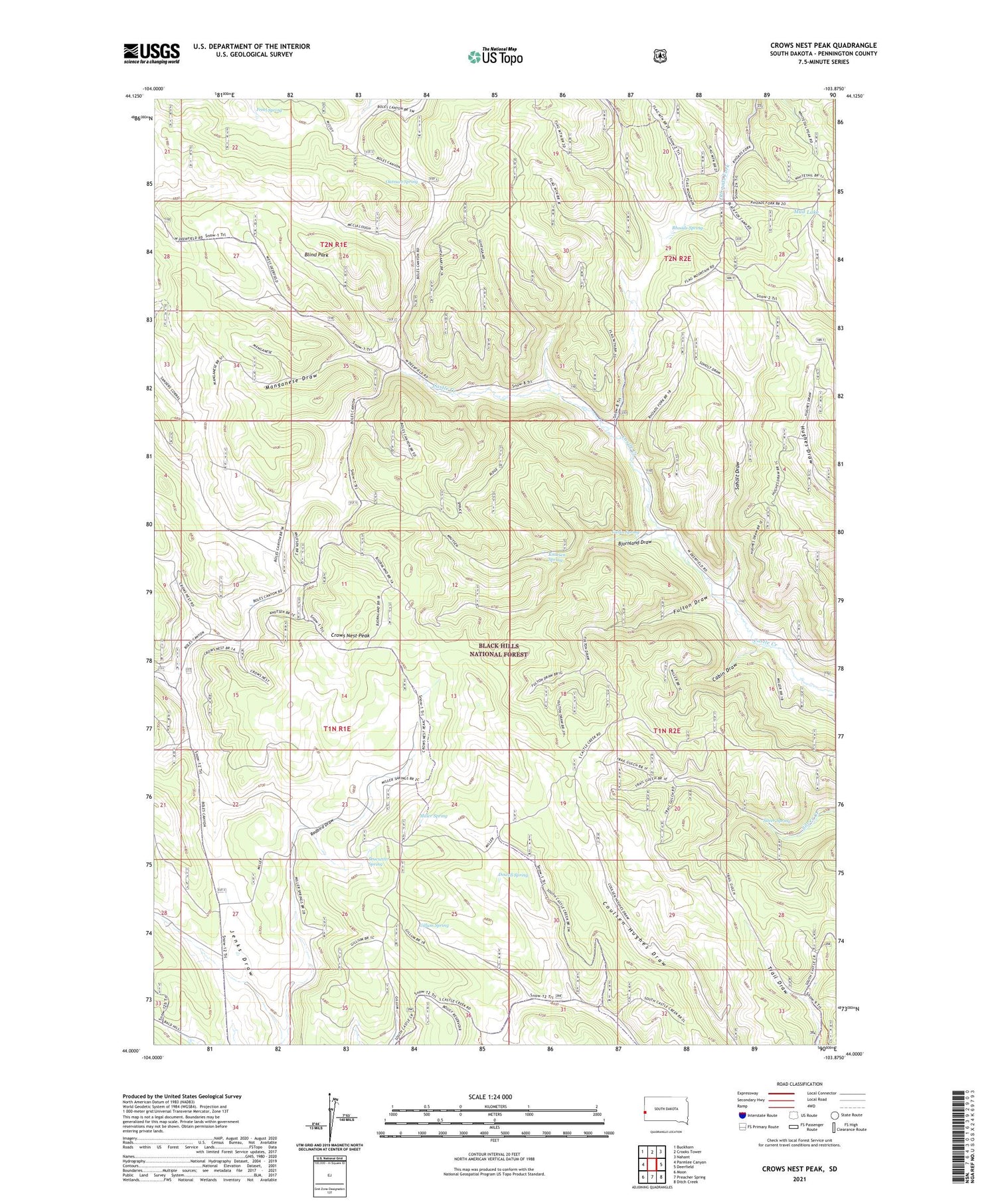
Crows Nest Peak South Dakota US Topo Map
Couldn't load pickup availability
2021 topographic map quadrangle Crows Nest Peak in the state of South Dakota. Scale: 1:24000. Based on the newly updated USGS 7.5' US Topo map series, this map is in the following counties: Pennington. The map contains contour data, water features, and other items you are used to seeing on USGS maps, but also has updated roads and other features. This is the next generation of topographic maps. Printed on high-quality waterproof paper with UV fade-resistant inks.
Quads adjacent to this one:
West: Parmlee Canyon
Northwest: Buckhorn
North: Crooks Tower
Northeast: Nahant
East: Deerfield
Southeast: Ditch Creek
South: Preacher Spring
Southwest: Moon
Contains the following named places: Badget Ranch, Beaver Creek Camp, Berry Ranch, Bjornland Draw, Blind Park, Cabin Draw, Cabin Spring, Cattles Ranch, Crows Nest Peak, Dolan Ranch, Dowell Spring, Eyster Ranch, Freel Spring, Fulton Draw, Gillum Spring, Harper Ranch, Jenks Draw, Knutsen Spring, Luhtasaari Ranch, Manganese Draw, McCoy Ranch, McCullough Ranch, Mickelson Ranch, Miller Spring, Mud Lake, Mud Lake Gravel Pit, Oatman Spring, Procunter Spring, Rhoads Ranch, Rhoads Spring, Scott Ranch, Silver Spring, Soholt Draw, Soholt Ranch, Thompson Ranch, Tysdal Ranch, Y-Park