MyTopo
Delmont SE South Dakota US Topo Map
Couldn't load pickup availability
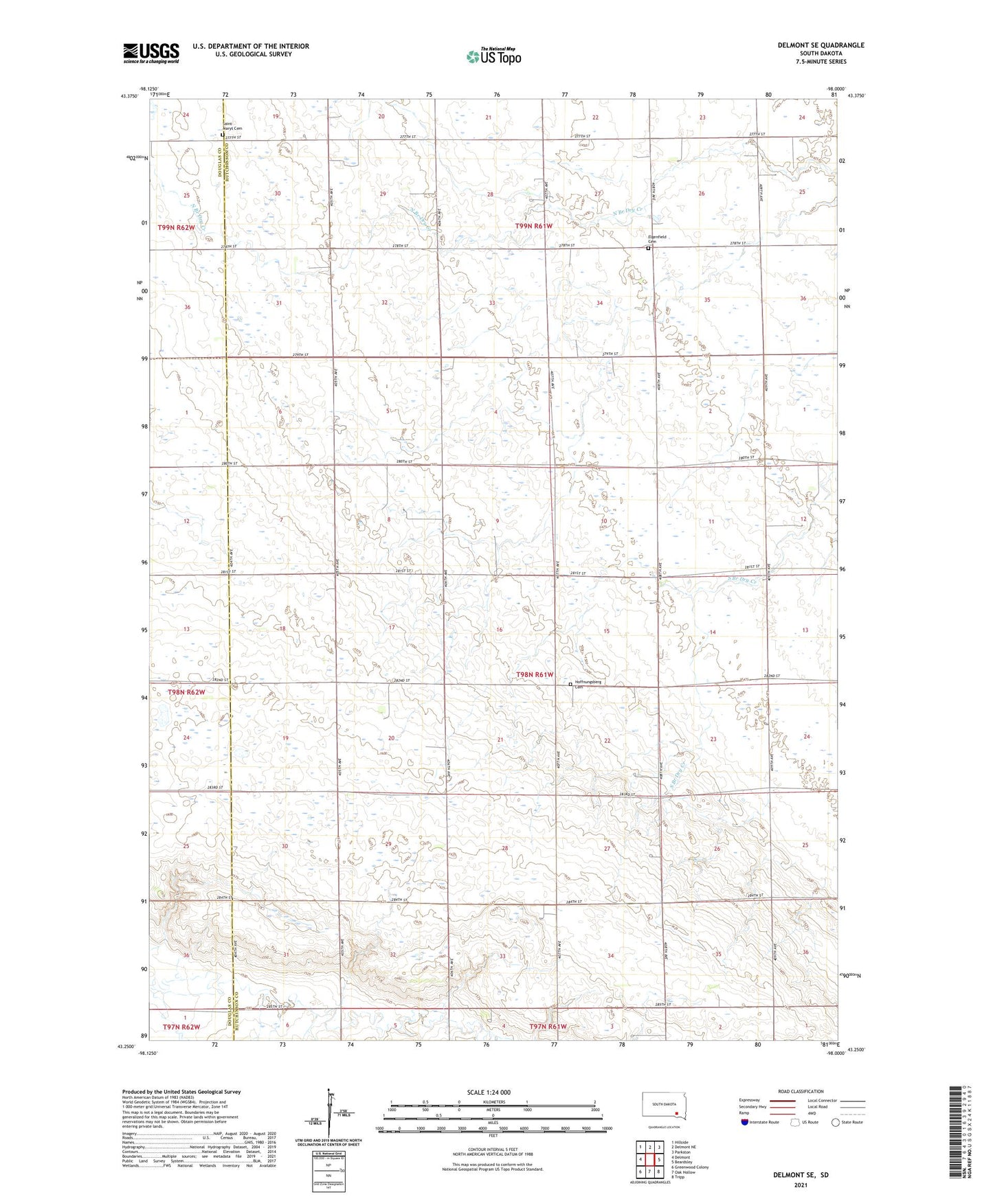
2021 topographic map quadrangle Delmont SE in the state of South Dakota. Scale: 1:24000. Based on the newly updated USGS 7.5' US Topo map series, this map is in the following counties: Hutchinson, Douglas. The map contains contour data, water features, and other items you are used to seeing on USGS maps, but also has updated roads and other features. This is the next generation of topographic maps. Printed on high-quality waterproof paper with UV fade-resistant inks.
Quads adjacent to this one:
West: Delmont
Northwest: Hillside
North: Delmont NE
Northeast: Parkston
East: Beardsley
Southeast: Tripp
South: Oak Hollow
Southwest: Greenwood Colony
This map covers the same area as the classic USGS quad with code o43098c1.
Contains the following named places: Delmont Country Club, Elgenfield Cemetery, Hoffnungsberg Cemetery, Saint Marys Cemetery, Township of Kulm