MyTopo
Parker South Dakota US Topo Map
Couldn't load pickup availability
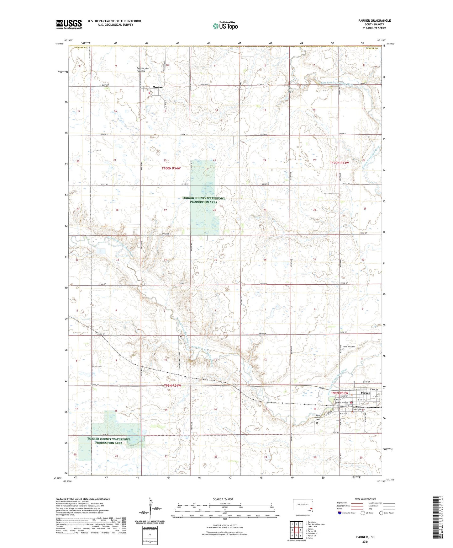
2021 topographic map quadrangle Parker in the state of South Dakota. Scale: 1:24000. Based on the newly updated USGS 7.5' US Topo map series, this map is in the following counties: Turner, McCook, Minnehaha. The map contains contour data, water features, and other items you are used to seeing on USGS maps, but also has updated roads and other features. This is the next generation of topographic maps. Printed on high-quality waterproof paper with UV fade-resistant inks.
Quads adjacent to this one:
West: Marion
Northwest: Canistota
North: East Vermillion Lake
Northeast: Grass Lake
East: Parker NE
Southeast: Hurley
South: Parker SW
Southwest: Freeman SE
This map covers the same area as the classic USGS quad with code o43097d2.
Contains the following named places: City of Parker, Monroe, Monroe Volunteer Fire Department, Parker, Parker Ambulance Service, Parker City Hall, Parker Elementary School, Parker High School, Parker Middle School, Parker Police Department, Parker Post Office, Parker Public Library, Parker Volunteer Fire Department, Par-Mar Valley Country Club, Rose Hill Cemetery, Saint Christina Cemetery, Thunder Valley Drag Strip, Town of Monroe, Township of Marion, Township of Monroe, Turner County Courthouse, Turner County Sheriff's Office, Turner County Waterfowl Production Area, ZIP Code: 57053