
MyTopo
Grass Lake South Dakota US Topo Map
Couldn't load pickup availability
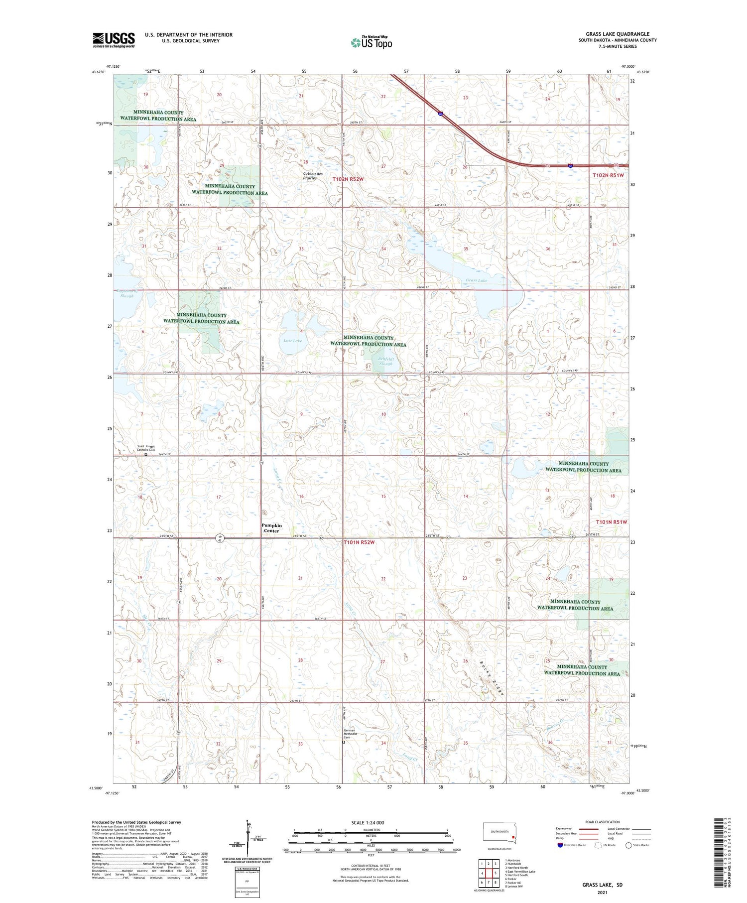
2021 topographic map quadrangle Grass Lake in the state of South Dakota. Scale: 1:24000. Based on the newly updated USGS 7.5' US Topo map series, this map is in the following counties: Minnehaha. The map contains contour data, water features, and other items you are used to seeing on USGS maps, but also has updated roads and other features. This is the next generation of topographic maps. Printed on high-quality waterproof paper with UV fade-resistant inks.
Quads adjacent to this one:
West: East Vermillion Lake
Northwest: Montrose
North: Humboldt
Northeast: Hartford North
East: Hartford South
Southeast: Lennox NW
South: Parker NE
Southwest: Parker
Contains the following named places: Celton, Englehardt Slough, Fensterman Slough, German Methodist Cemetery, Grass Lake, Lost Lake, Midwest School Number 71, Pumpkin Center, Rehfeldt Slough, Rocky Ridge, Saint Joseph Catholic Cemetery, Saint Joseph Catholic Church, Township of Wellington, Union Center, Wellington


