MyTopo
Okaton SE South Dakota US Topo Map
Couldn't load pickup availability
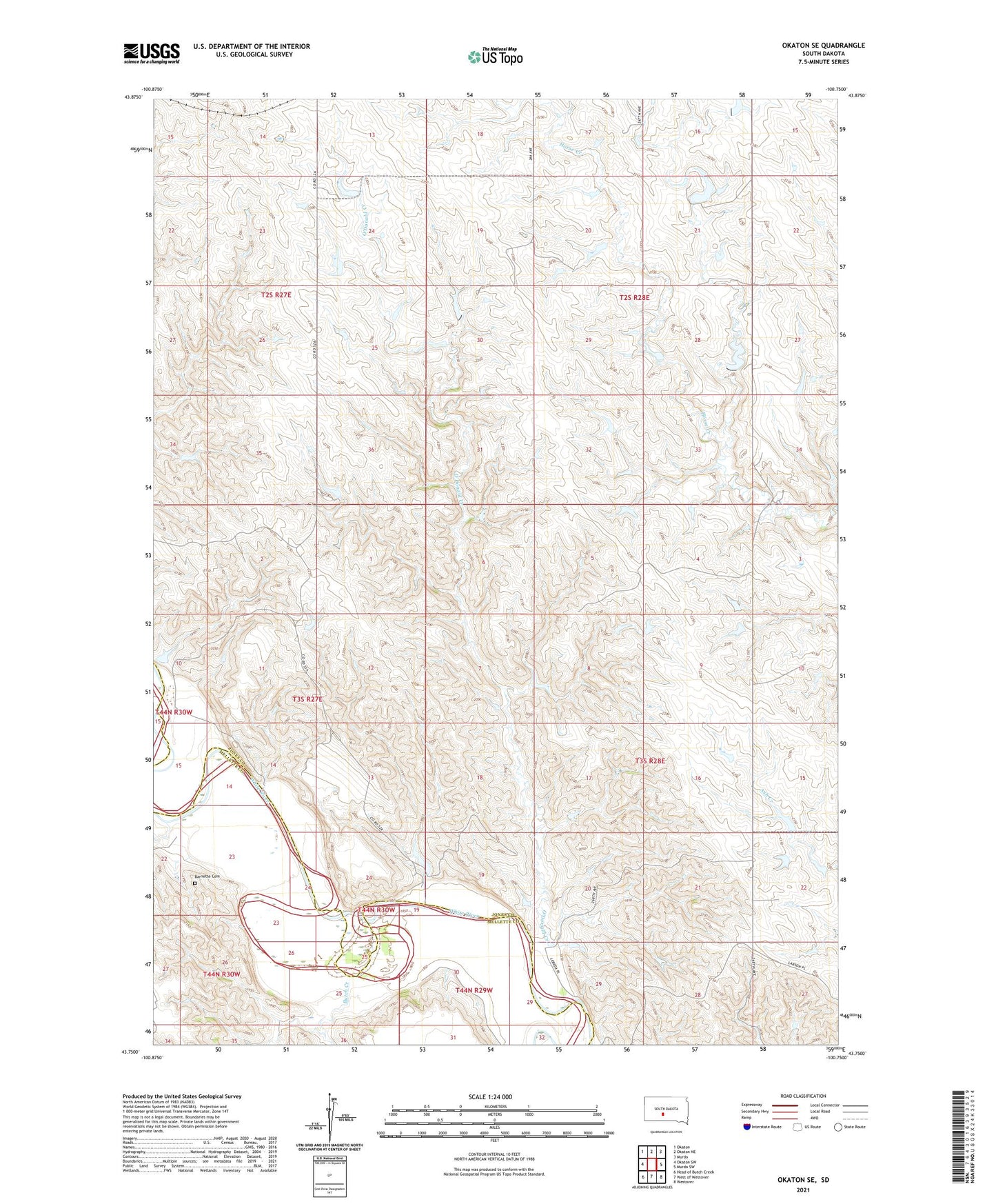
2021 topographic map quadrangle Okaton SE in the state of South Dakota. Scale: 1:24000. Based on the newly updated USGS 7.5' US Topo map series, this map is in the following counties: Jones, Mellette. The map contains contour data, water features, and other items you are used to seeing on USGS maps, but also has updated roads and other features. This is the next generation of topographic maps. Printed on high-quality waterproof paper with UV fade-resistant inks.
Quads adjacent to this one:
West: Okaton SW
Northwest: Okaton
North: Okaton NE
Northeast: Murdo
East: Murdo SW
Southeast: Westover
South: West of Westover
Southwest: Head of Butch Creek
This map covers the same area as the classic USGS quad with code o43100g7.
Contains the following named places: Barnette Cemetery, Brost Number 1 Dam, Brost Number 10 Dam, Brost Number 2 Dam, Brost Number 3 Dam, Brost Number 4 Dam, Brost Number 5 Dam, Brost Number 6 Dam, Butch Creek, Dykstra Number 1 Dam, Dykstra Number 10 Dam, Dykstra Number 11 Dam, Dykstra Number 12 Dam, Dykstra Number 14 Dam, Dykstra Number 2 Dam, Dykstra Number 3 Dam, Dykstra Number 4 Dam, Dykstra Number 5 Dam, Dykstra Number 6 Dam, Dykstra Number 7 Dam, Dykstra Number 8 Dam, Dykstra Number 9 Dam, Hix Number 1 Dam, O'Donald Creek, Richardson Number 2 Dam, Roundup Creek, Toledo, Tornow Number 1 Dam, Township of Mullen, Township of Murdo