MyTopo
Ideal NW South Dakota US Topo Map
Couldn't load pickup availability
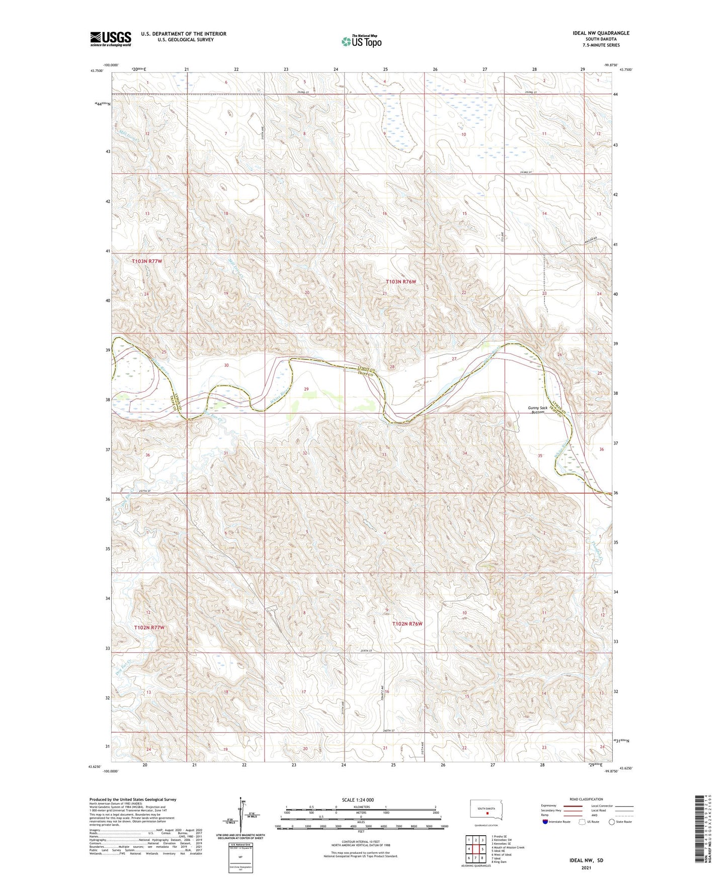
2021 topographic map quadrangle Ideal NW in the state of South Dakota. Scale: 1:24000. Based on the newly updated USGS 7.5' US Topo map series, this map is in the following counties: Tripp, Lyman. The map contains contour data, water features, and other items you are used to seeing on USGS maps, but also has updated roads and other features. This is the next generation of topographic maps. Printed on high-quality waterproof paper with UV fade-resistant inks.
Quads adjacent to this one:
West: Mouth of Mission Creek
Northwest: Presho SE
North: Kennebec SW
Northeast: Kennebec SE
East: Ideal NE
Southeast: King Dam
South: Ideal
Southwest: West of Ideal
This map covers the same area as the classic USGS quad with code o43099f8.
Contains the following named places: Bruck Herman Dam, Christensen Ranch, Dog Ear Creek, Edna, Edna School, Frantz Farms 4 Dam, Gunny Sack Bottom, Ideal Segment, Kewley Ranch, Labrecque Dam, Lee Calhoon 1 Dam, Lee Calhoon 2 Dam, Mill Iron Creek, Sylvia, Township of Edna, Township of Star Valley