MyTopo
Wessington Springs SW South Dakota US Topo Map
Couldn't load pickup availability
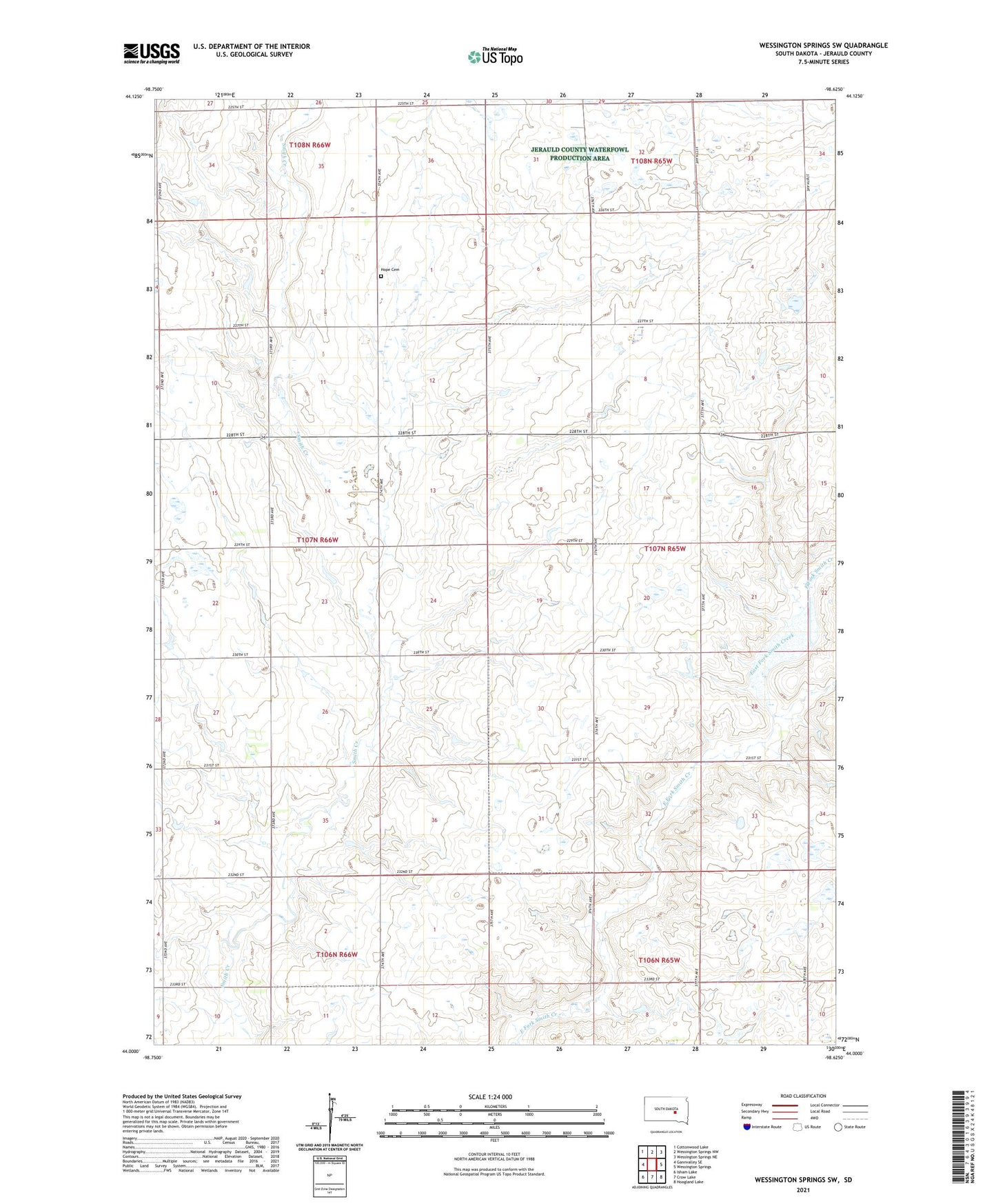
2021 topographic map quadrangle Wessington Springs SW in the state of South Dakota. Scale: 1:24000. Based on the newly updated USGS 7.5' US Topo map series, this map is in the following counties: Jerauld. The map contains contour data, water features, and other items you are used to seeing on USGS maps, but also has updated roads and other features. This is the next generation of topographic maps. Printed on high-quality waterproof paper with UV fade-resistant inks.
Quads adjacent to this one:
West: Gannvalley SE
Northwest: Cottonwood Lake
North: Wessington Springs NW
Northeast: Wessington Springs NE
East: Wessington Springs
Southeast: Hoagland Lake
South: Crow Lake
Southwest: Isham Lake
This map covers the same area as the classic USGS quad with code o44098a6.
Contains the following named places: Bolton School Number 3, Dean School Number 3, Fauston Post Office, Hainey School Number 4, Happy Hill School, Hope Cemetery, Jerauld County, Martin School Number 1, Pleasant View School, Powell School Number 1, School Number 9, Schubert School, Stetson, Templeton, Templeton Church, Templeton School Number 4, Township of Media, Township of Pleasant, Unorganized Territory of Media, ZIP Code: 57382