MyTopo
Crow Lake South Dakota US Topo Map
Couldn't load pickup availability
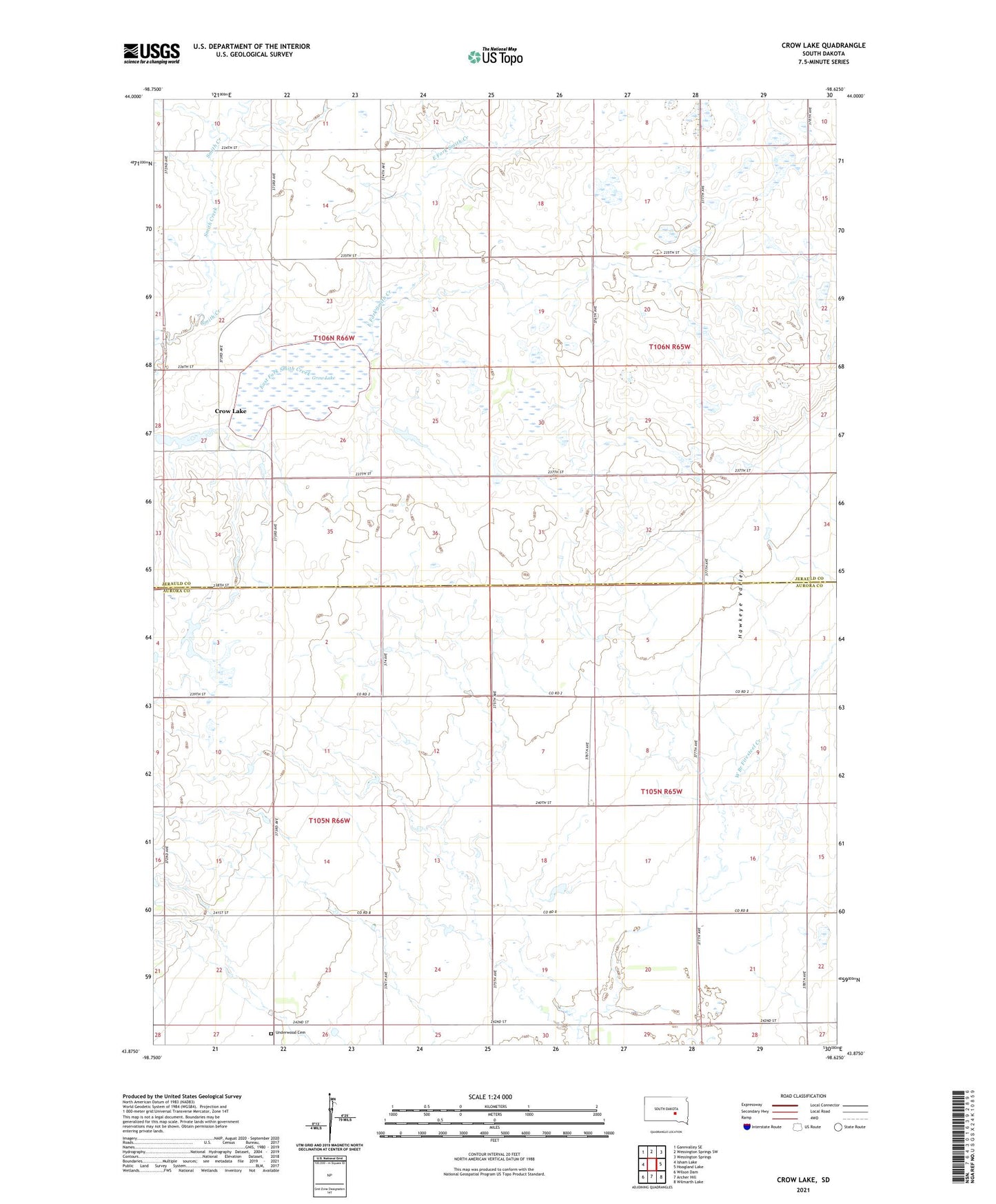
2021 topographic map quadrangle Crow Lake in the state of South Dakota. Scale: 1:24000. Based on the newly updated USGS 7.5' US Topo map series, this map is in the following counties: Jerauld, Aurora. The map contains contour data, water features, and other items you are used to seeing on USGS maps, but also has updated roads and other features. This is the next generation of topographic maps. Printed on high-quality waterproof paper with UV fade-resistant inks.
Quads adjacent to this one:
West: Isham Lake
Northwest: Gannvalley SE
North: Wessington Springs SW
Northeast: Wessington Springs
East: Hoagland Lake
Southeast: Wilmarth Lake
South: Archer Hill
Southwest: Wilson Dam
This map covers the same area as the classic USGS quad with code k43098h5.
Contains the following named places: Central School, Crow Lake, Crow Lake Post Office, Crow Lake School, Crow Lake State Game Production Area, Grow Lake, Hall School, Hawkeye Valley, Horseshoe Lake State Game Production Area, Nelson School, Patten School, Sefrna School, Township of Anina, Township of Crow Lake, Township of Patten, Township of Pleasant Valley, Underwood Cemetery, Underwood Church, Whittier School