MyTopo
Kloucek Lake South Dakota US Topo Map
Couldn't load pickup availability
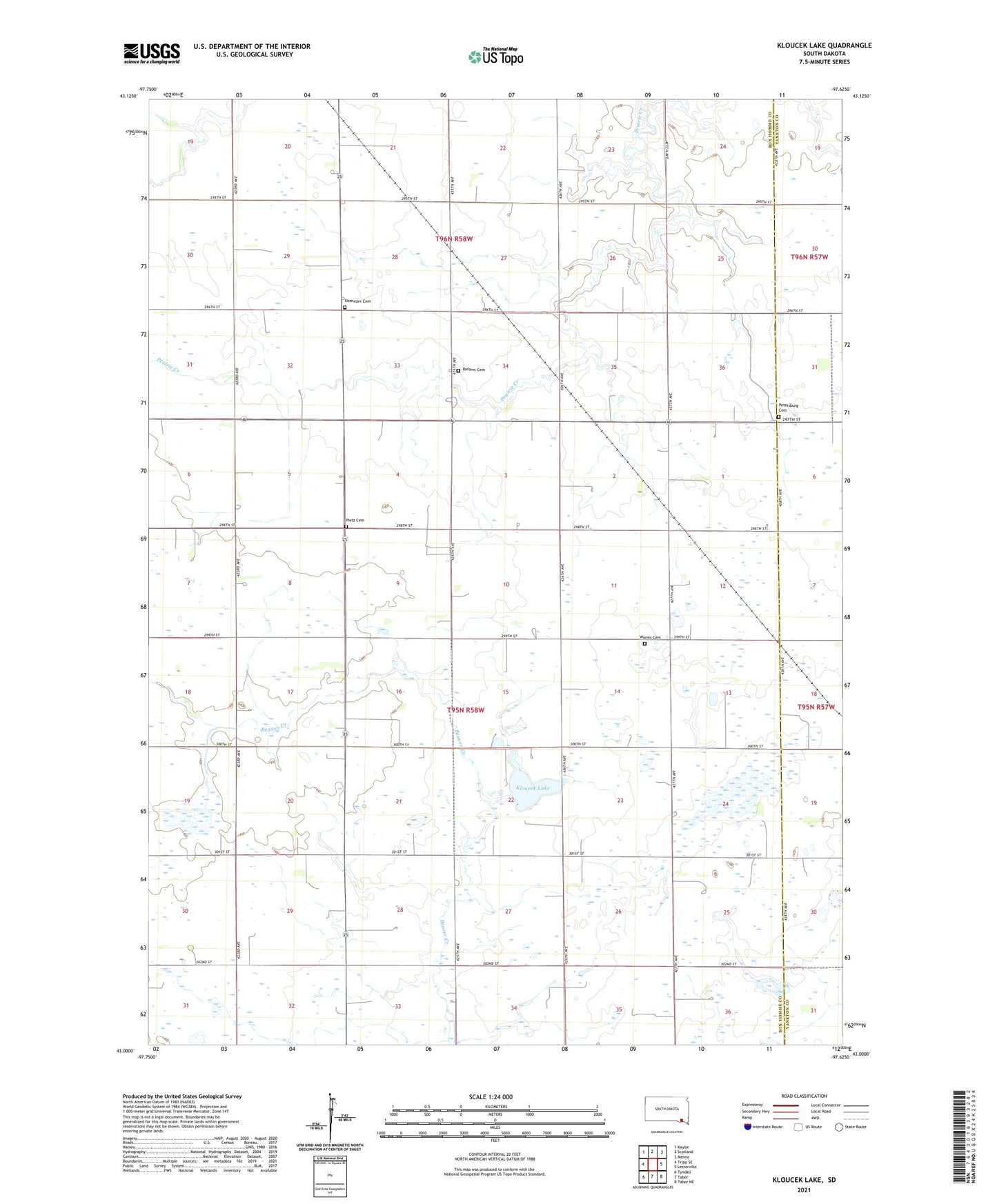
2021 topographic map quadrangle Kloucek Lake in the state of South Dakota. Scale: 1:24000. Based on the newly updated USGS 7.5' US Topo map series, this map is in the following counties: Bon Homme, Yankton. The map contains contour data, water features, and other items you are used to seeing on USGS maps, but also has updated roads and other features. This is the next generation of topographic maps. Printed on high-quality waterproof paper with UV fade-resistant inks.
Quads adjacent to this one:
West: Tripp SE
Northwest: Kaylor
North: Scotland
Northeast: Menno
East: Lesterville
Southeast: Tabor NE
South: Tabor
Southwest: Tyndall
This map covers the same area as the classic USGS quad with code o43097a6.
Contains the following named places: Ebenezer Cemetery, Kloucek Lake, Lutheran Church, Petersburg Cemetery, Pietz Cemetery, Reform Cemetery, School Number 14, School Number 15, School Number 16, School Number 20, School Number 21, School Number 7, School Number 79, Township of Lincoln, Worms Cemetery