MyTopo
Slaughter Reservoir South Dakota US Topo Map
Couldn't load pickup availability
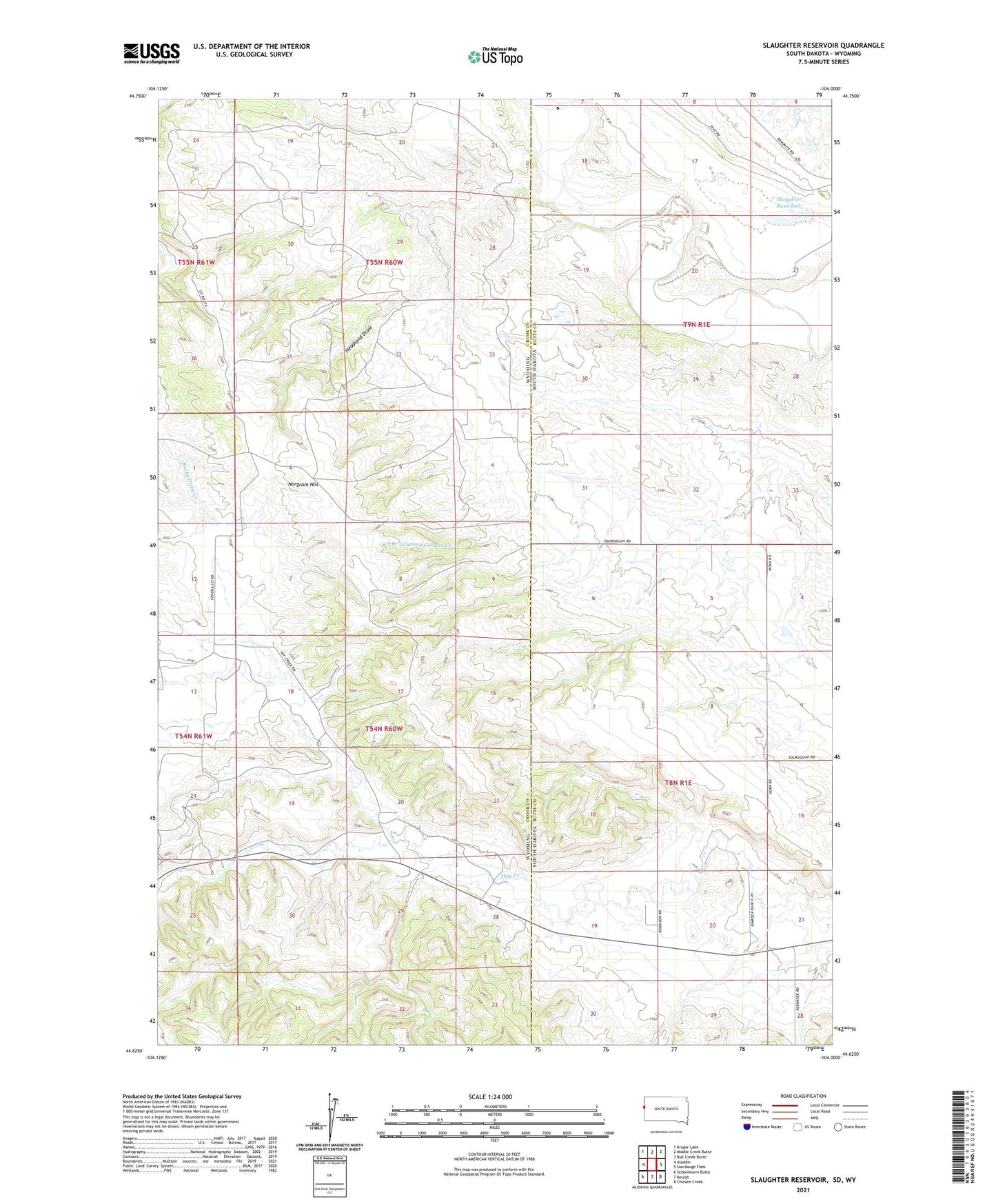
2021 topographic map quadrangle Slaughter Reservoir in the states of Wyoming, South Dakota. Scale: 1:24000. Based on the newly updated USGS 7.5' US Topo map series, this map is in the following counties: Butte, Crook. The map contains contour data, water features, and other items you are used to seeing on USGS maps, but also has updated roads and other features. This is the next generation of topographic maps. Printed on high-quality waterproof paper with UV fade-resistant inks.
Quads adjacent to this one:
West: Aladdin
Northwest: Kruger Lake
North: Middle Creek Butte
Northeast: Bull Creek Butte
East: Sourdough Flats
Southeast: Chicken Creek
South: Beulah
Southwest: Schoolmarm Butte
Contains the following named places: A A Sisson Mine, A R Nelson Property Mine, Black Vein Seven Mine, Budmayer Ranch, C Helmer Property Mine, Cooper Ranch, Couch Ranch, Fishel Ranch, Fuller Ranch, Hall Ranch, Headland Draw, Heetland Mine, Heetland Ranch, Helmer Mine, Helmer Ranch, Helmer Ranch Mine, Hutchinson Ranch, Lake Reservoir Area Number Two Mine, Lightner Ranch, Massie Ranch, Middle Fork Hay Creek, Nelson Mine, Norgrain Hill, North Fork Hay Creek, Oak Creek Dam, Pine Draw Creek, Ribey Ranch, Robinson Ranch, Sisson Mine, Slaughter Reservoir, South Branch Grummit Canyon Creek, South Fork Hay Creek, State Lease Number 0-22090 Mine, Sunny Slope School, The Forks, Williams Ranch, Wolfe Ranch