MyTopo
Midway South Dakota US Topo Map
Couldn't load pickup availability
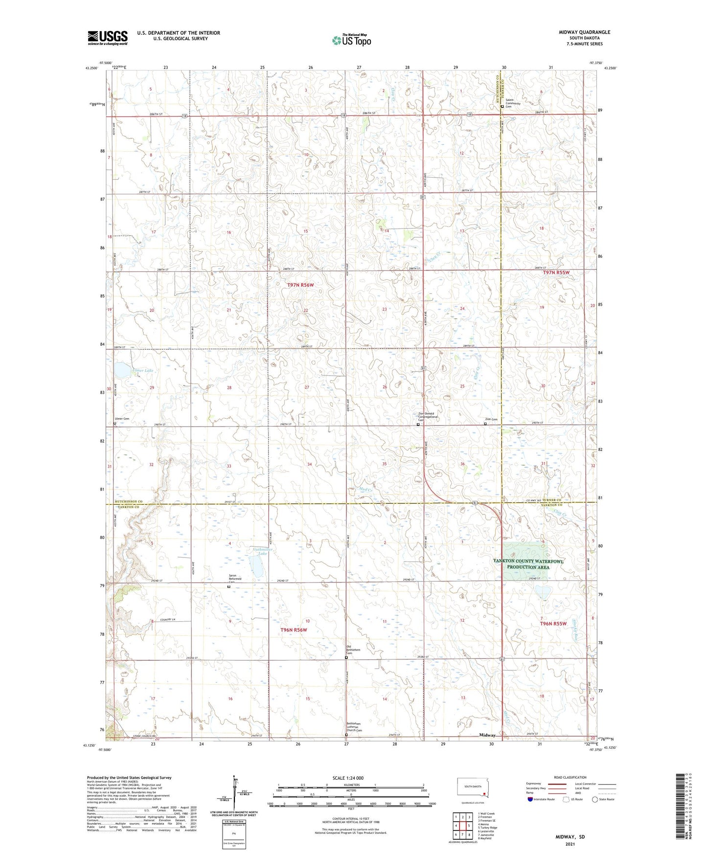
2021 topographic map quadrangle Midway in the state of South Dakota. Scale: 1:24000. Based on the newly updated USGS 7.5' US Topo map series, this map is in the following counties: Hutchinson, Yankton, Turner. The map contains contour data, water features, and other items you are used to seeing on USGS maps, but also has updated roads and other features. This is the next generation of topographic maps. Printed on high-quality waterproof paper with UV fade-resistant inks.
Quads adjacent to this one:
West: Menno
Northwest: Wolf Creek
North: Freeman
Northeast: Freeman SE
East: Turkey Ridge
Southeast: Mayfield
South: Jamesville
Southwest: Lesterville
Contains the following named places: Bender School, Bethlehem Church, Bethlehem Lutheran Church Cemetery, Guthmiller Lake, Handel School, Independence School, Midway, Molan, Molan School, Morningstar School, Old Bethlehem Cemetery, Oswald School, Peterson School, Salem Church, Salem Community Cemetery, Saron Church, Saron Reformed Cemetery, Schaeffer School, Township of Jamesville, Township of Molan, Ulmer Cemetery, Ulmer Lake, Ulmer School, Yankton County Waterfowl Production Area, Zion Cemetery, Zion Church, Zion Oswald Congregational Cemetery