MyTopo
Beardsley South Dakota US Topo Map
Couldn't load pickup availability
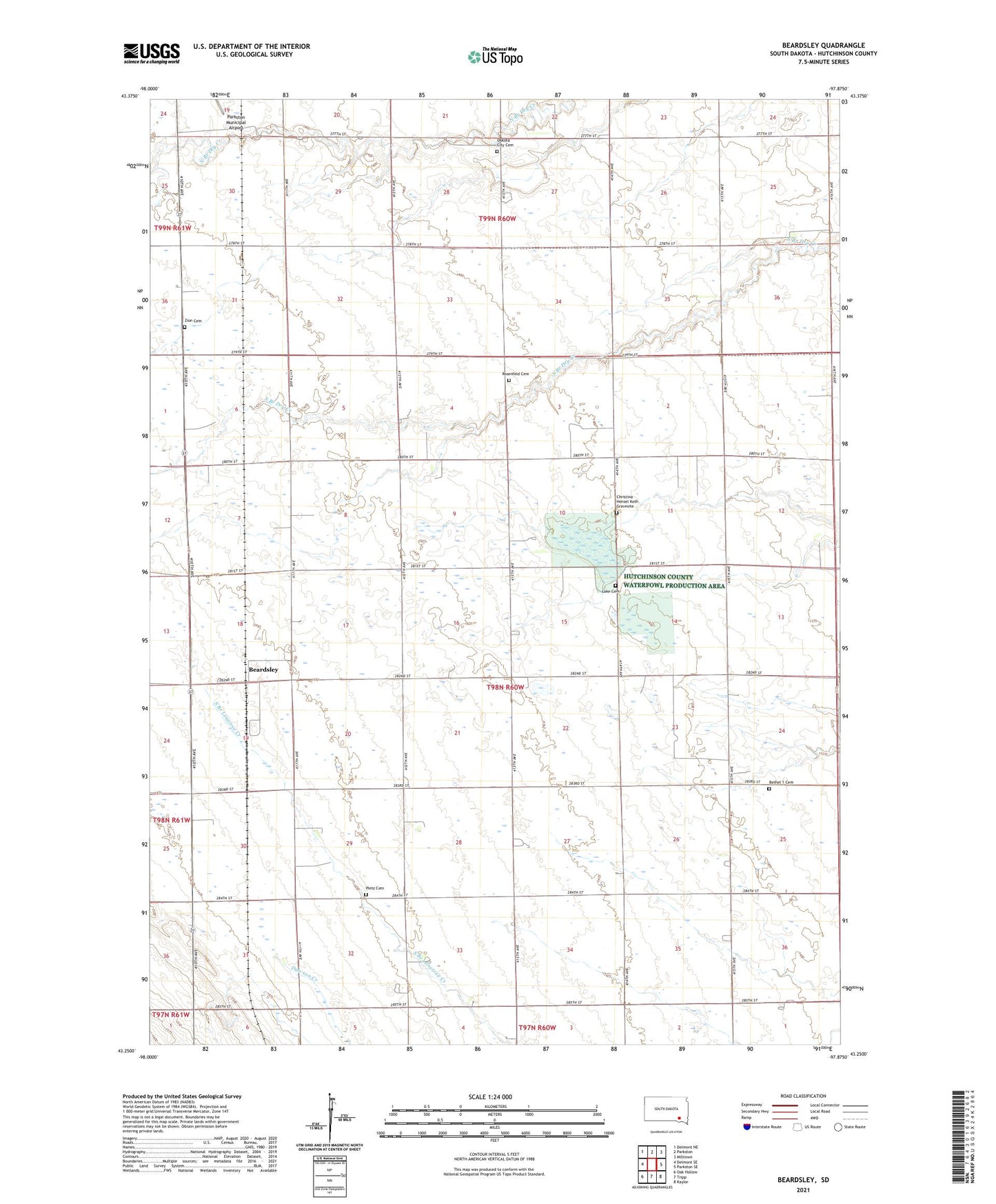
2021 topographic map quadrangle Beardsley in the state of South Dakota. Scale: 1:24000. Based on the newly updated USGS 7.5' US Topo map series, this map is in the following counties: Hutchinson. The map contains contour data, water features, and other items you are used to seeing on USGS maps, but also has updated roads and other features. This is the next generation of topographic maps. Printed on high-quality waterproof paper with UV fade-resistant inks.
Quads adjacent to this one:
West: Delmont SE
Northwest: Delmont NE
North: Parkston
Northeast: Milltown
East: Parkston SE
Southeast: Kaylor
South: Tripp
Southwest: Oak Hollow
This map covers the same area as the classic USGS quad with code o43097c8.
Contains the following named places: Beardsley, Bethel 1 Cemetery, Christina Hensel Koth Gravesite, Dakota City Cemetery, Eliza, Hutchinson County Waterfowl Production Area, Lake Cemetery, Parkston Country Club, Pietz Cemetery, Rezek Post Office, Rosenfeld Cemetery, Township of German, Zion Cemetery