MyTopo
Avon South Dakota US Topo Map
Couldn't load pickup availability
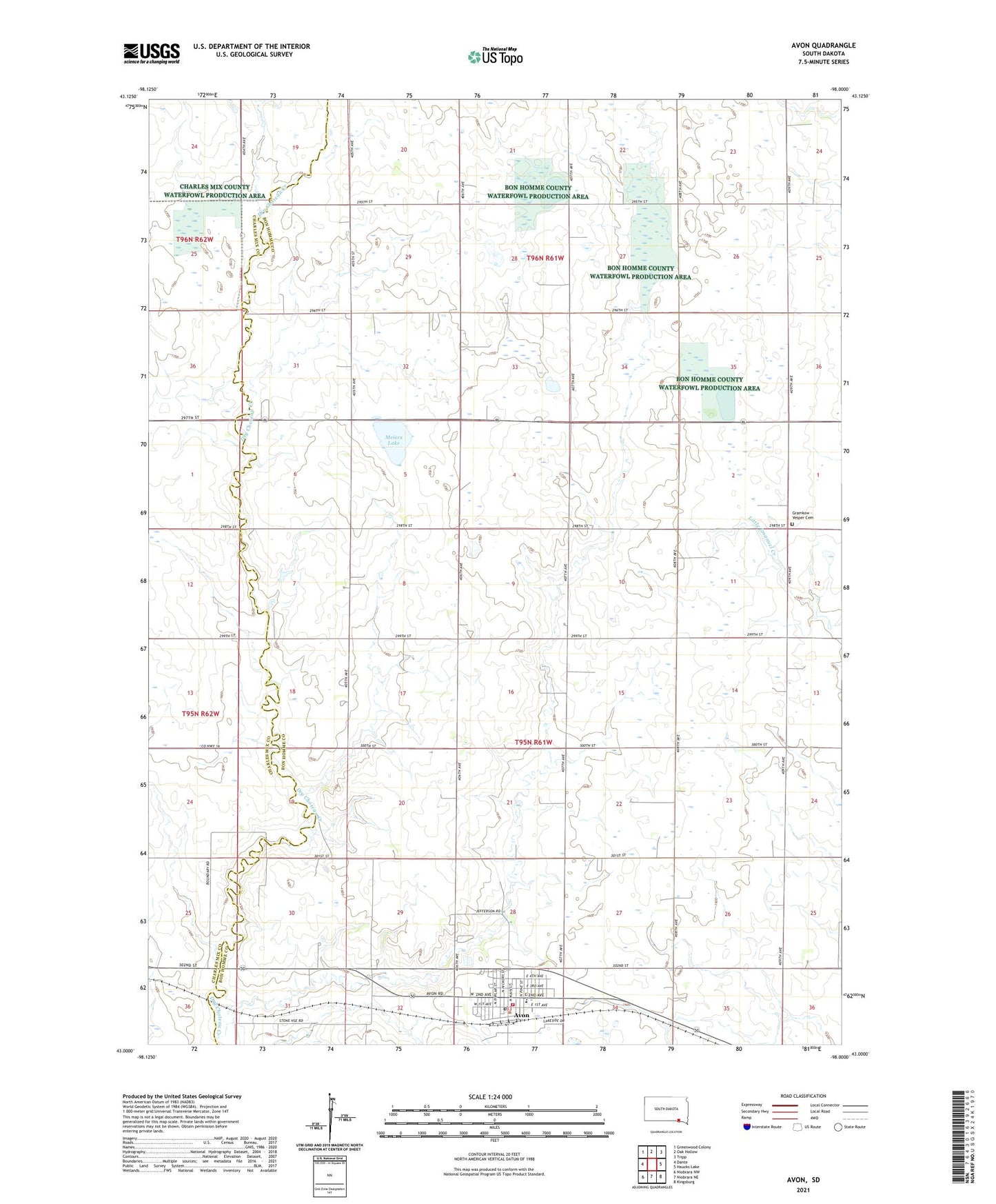
2021 topographic map quadrangle Avon in the state of South Dakota. Scale: 1:24000. Based on the newly updated USGS 7.5' US Topo map series, this map is in the following counties: Bon Homme, Charles Mix. The map contains contour data, water features, and other items you are used to seeing on USGS maps, but also has updated roads and other features. This is the next generation of topographic maps. Printed on high-quality waterproof paper with UV fade-resistant inks.
Quads adjacent to this one:
West: Dante
Northwest: Greenwood Colony
North: Oak Hollow
Northeast: Tripp
East: Haucks Lake
Southeast: Kingsburg
South: Niobrara NE
Southwest: Niobrara NW
This map covers the same area as the classic USGS quad with code o43098a1.
Contains the following named places: Avon, Avon City Hall, Avon Elementary School, Avon Fire Department, Avon High School, Avon Junior High School, Avon Police Department, Avon Post Office, Avon Public Library, Avon Save - A - Life Ambulance Service, City of Avon, Giedd School, Gramkow - Vesper Cemetery, Meiers Lake, School Number 55, School Number 56, School Number 57, School Number 66, School Number 67, School Number 69, Township of Avon, Township of Clinton