MyTopo
Owanka South Dakota US Topo Map
Couldn't load pickup availability
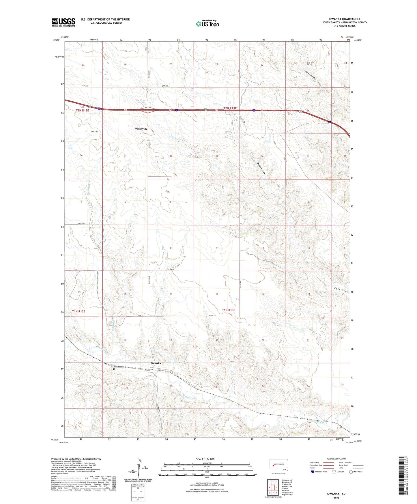
2021 topographic map quadrangle Owanka in the state of South Dakota. Scale: 1:24000. Based on the newly updated USGS 7.5' US Topo map series, this map is in the following counties: Pennington. The map contains contour data, water features, and other items you are used to seeing on USGS maps, but also has updated roads and other features. This is the next generation of topographic maps. Printed on high-quality waterproof paper with UV fade-resistant inks.
Quads adjacent to this one:
West: Owanka SW
Northwest: Owanka NW
North: Owanka NE
Northeast: Wasta NW
East: Wasta
Southeast: Quinn Table
South: Brennan Flat
Southwest: Creston
This map covers the same area as the classic USGS quad with code o44102a5.
Contains the following named places: Elmer Olseon Dam, Fuller School, Madison Draw, Owanka, Owanka 1 Dam, Owanka Cemetery, Patterson Creek, Simon School, Township of Owanka, Wayside School, Wicksville, Wicksville 1 Dam, Wicksville Community School