MyTopo
Brennan Flat South Dakota US Topo Map
Couldn't load pickup availability
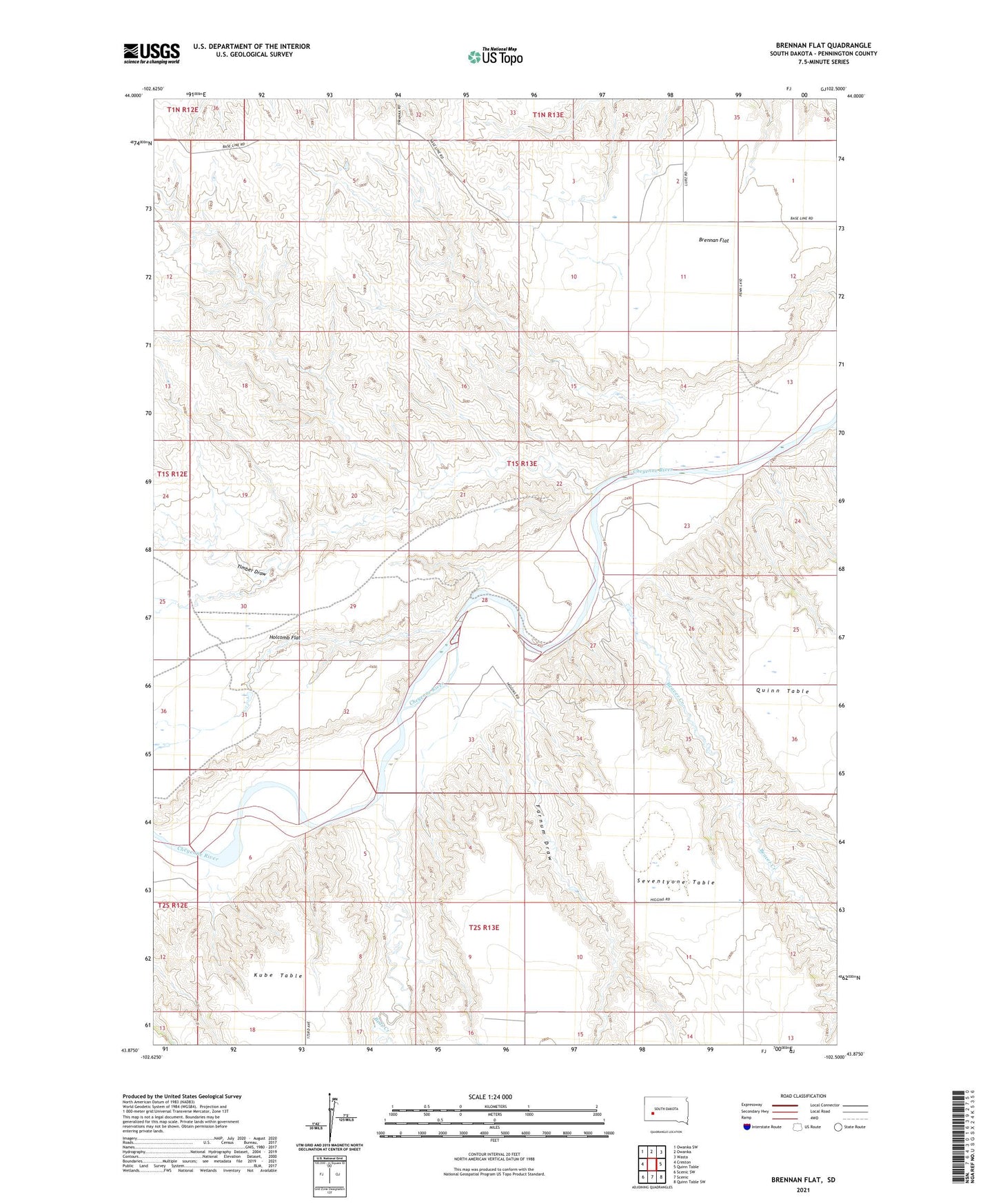
2021 topographic map quadrangle Brennan Flat in the state of South Dakota. Scale: 1:24000. Based on the newly updated USGS 7.5' US Topo map series, this map is in the following counties: Pennington. The map contains contour data, water features, and other items you are used to seeing on USGS maps, but also has updated roads and other features. This is the next generation of topographic maps. Printed on high-quality waterproof paper with UV fade-resistant inks.
Quads adjacent to this one:
West: Creston
Northwest: Owanka SW
North: Owanka
Northeast: Wasta
East: Quinn Table
Southeast: Quinn Table SW
South: Scenic
Southwest: Scenic SW
This map covers the same area as the classic USGS quad with code o43102h5.
Contains the following named places: Anderson Draw, Bear Creek, Beaver Creek, Brennan Flat, Centerville School, Farnum Draw, Holcomb Flat, Timber Draw