MyTopo
Wasta South Dakota US Topo Map
Couldn't load pickup availability
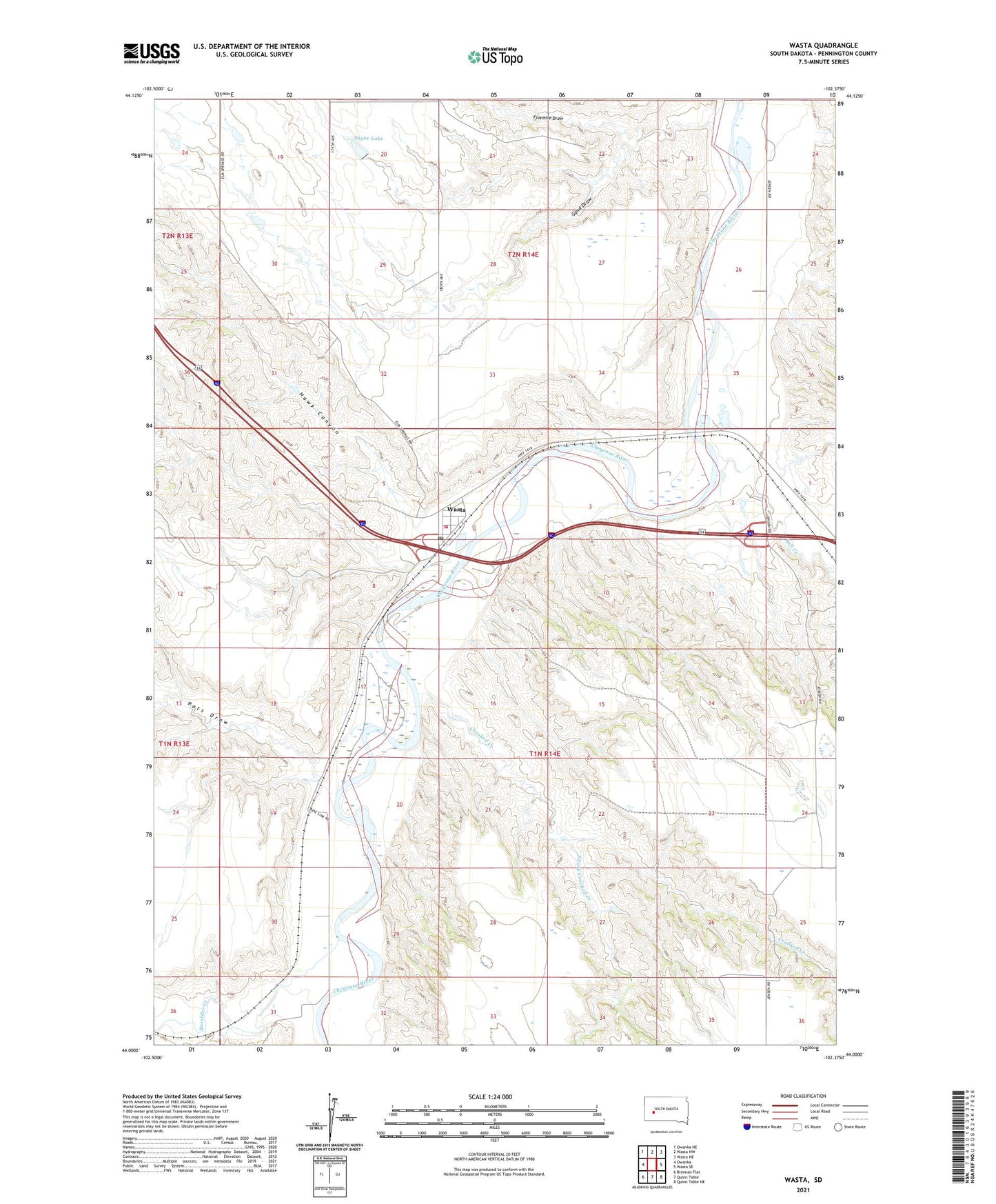
2021 topographic map quadrangle Wasta in the state of South Dakota. Scale: 1:24000. Based on the newly updated USGS 7.5' US Topo map series, this map is in the following counties: Pennington. The map contains contour data, water features, and other items you are used to seeing on USGS maps, but also has updated roads and other features. This is the next generation of topographic maps. Printed on high-quality waterproof paper with UV fade-resistant inks.
Quads adjacent to this one:
West: Owanka
Northwest: Owanka NE
North: Wasta NW
Northeast: Wasta NE
East: Wasta SE
Southeast: Quinn Table NE
South: Quinn Table
Southwest: Brennan Flat
This map covers the same area as the classic USGS quad with code o44102a4.
Contains the following named places: Boxelder Creek, Bull Creek, Cedar Canyon, Crooked Creek, Dakota City Post Office, Fivemile Draw, Hawk Canyon, Pats Draw, Sand Draw, Shyne 1 Dam, Shyne Lake, South Fork Crooked Creek, Town of Wasta, Township of Shyne, Township of Wasta, Wasta, Wasta Post Office, Wasta Volunteer Fire Department