MyTopo
Tripp South Dakota US Topo Map
Couldn't load pickup availability
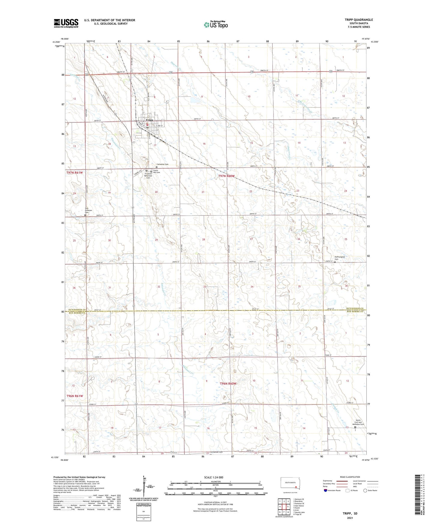
2021 topographic map quadrangle Tripp in the state of South Dakota. Scale: 1:24000. Based on the newly updated USGS 7.5' US Topo map series, this map is in the following counties: Hutchinson, Bon Homme. The map contains contour data, water features, and other items you are used to seeing on USGS maps, but also has updated roads and other features. This is the next generation of topographic maps. Printed on high-quality waterproof paper with UV fade-resistant inks.
Quads adjacent to this one:
West: Oak Hollow
Northwest: Delmont SE
North: Beardsley
Northeast: Parkston SE
East: Kaylor
Southeast: Tripp SE
South: Haucks Lake
Southwest: Avon
This map covers the same area as the classic USGS quad with code o43097b8.
Contains the following named places: Aden, Cathedral Cemetery, City of Tripp, Friedens Reformed Cemetery, Grace Hill Cemetery, Hoffnungstal Cemetery, Hutterthal, Immanuel Church, Saints Cyril and Mehodius Cemetery, Saints Cyril and Mehodius Church, Township of Emanuel, Township of Fair, Township of Sharon, Township of Tripp, Tripp, Tripp Ambulance Service, Tripp City Hall, Tripp Elementary School, Tripp Police Department, Tripp Post Office, Tripp Public Library, Tripp Volunteer Fire Department, Tripp-Delmont High School, Tripp-Delmont Middle School, Vodnany, Vodnany Post Office, Zion Lutheran Cemetery, ZIP Code: 57376