MyTopo
Tea South Dakota US Topo Map
Couldn't load pickup availability
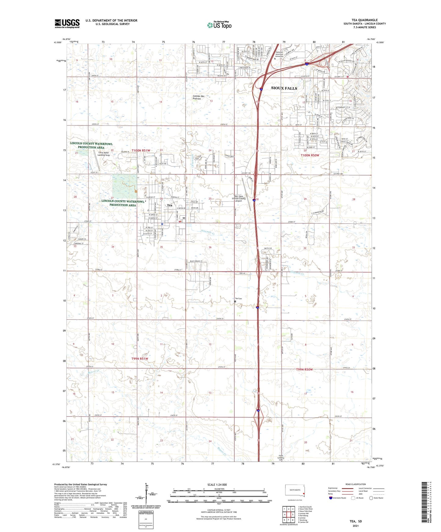
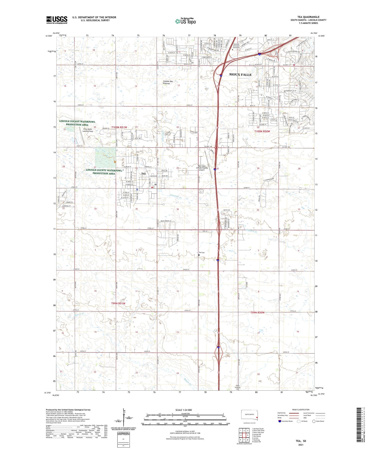
2021 topographic map quadrangle Tea in the state of South Dakota. Scale: 1:24000. Based on the newly updated USGS 7.5' US Topo map series, this map is in the following counties: Lincoln. The map contains contour data, water features, and other items you are used to seeing on USGS maps, but also has updated roads and other features. This is the next generation of topographic maps. Printed on high-quality waterproof paper with UV fade-resistant inks.
Quads adjacent to this one:
West: Lennox NW
Northwest: Hartford South
North: Sioux Falls West
Northeast: Sioux Falls East
East: Harrisburg
Southeast: Canton SW
South: Worthing
Southwest: Lennox
Contains the following named places: Antioch, Avera Behavioral Health Center, Avera Heart Hospital of South Dakota, Chris Hofer Landing Strip, City of Tea, Colorado Technical University - Sioux Falls, Evenson Dam, Explorer Elementary School, Globe University, KNWC-AM (Sioux Falls), KNWC-FM (Sioux Falls), Lincoln County Waterfowl Production Area, Marv Skie-Lincoln County Airport, National American University - Sioux Falls, Prairie View School, Rader School, Sioux Falls Fire Rescue Station 4, Tea, Tea Area Elementary School, Tea Area High School, Tea Area Middle School, Tea Cemetery, Tea City Hall, Tea Community Library, Tea Fire Department, Tea Police Department, Tea Post Office, Township of Delapre, Township of Perry, Twelve - Step Living Corporation Tallgrass Recovery Center, ZIP Code: 57064