MyTopo
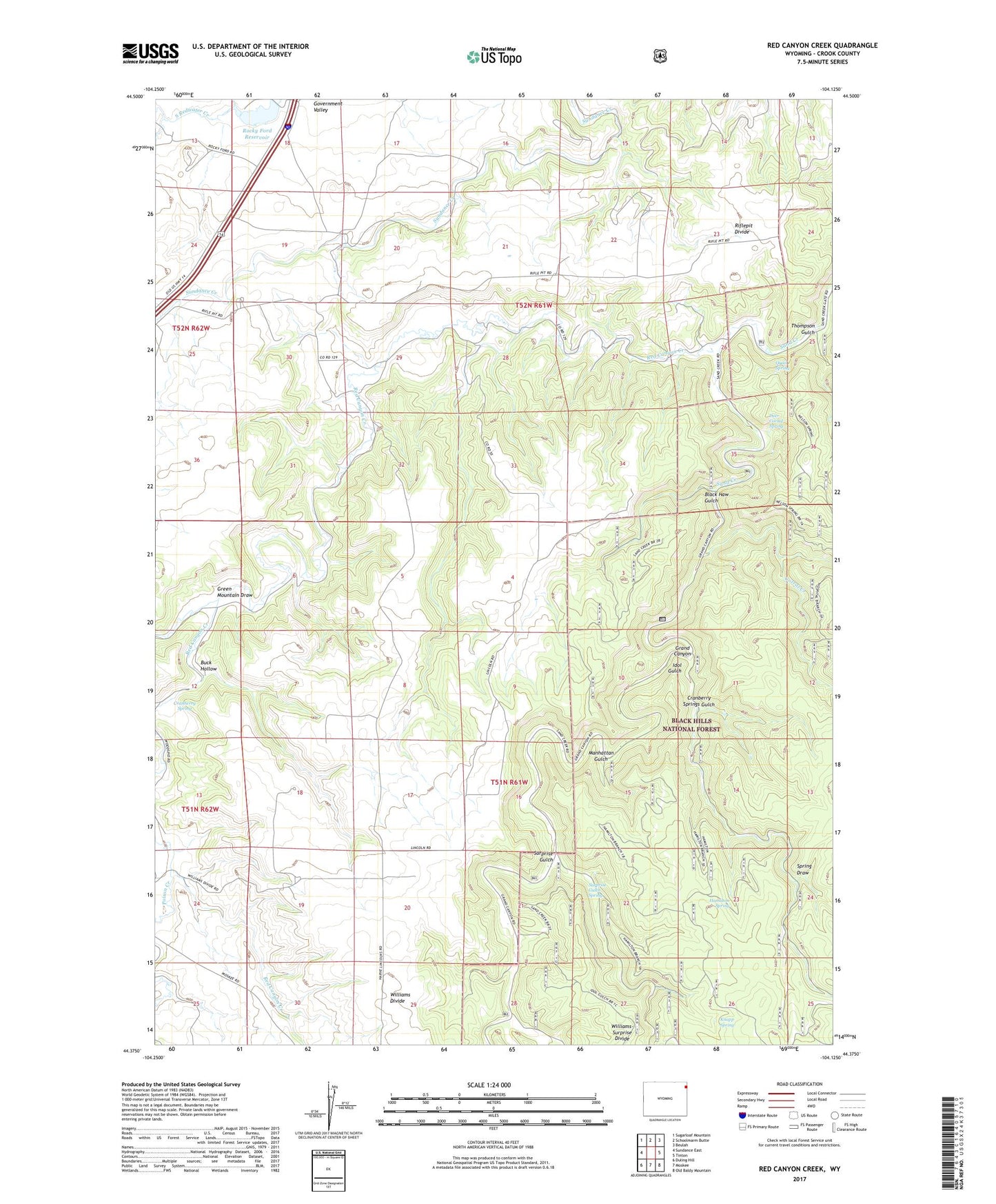
Red Canyon Creek Wyoming US Topo Map
Couldn't load pickup availability
Also explore the Red Canyon Creek Forest Service Topo of this same quad for updated USFS data
2021 topographic map quadrangle Red Canyon Creek in the state of Wyoming. Scale: 1:24000. Based on the newly updated USGS 7.5' US Topo map series, this map is in the following counties: Crook. The map contains contour data, water features, and other items you are used to seeing on USGS maps, but also has updated roads and other features. This is the next generation of topographic maps. Printed on high-quality waterproof paper with UV fade-resistant inks.
Quads adjacent to this one:
West: Sundance East
Northwest: Sugarloaf Mountain
North: Schoolmarm Butte
Northeast: Beulah
East: Tinton
Southeast: Old Baldy Mountain
South: Moskee
Southwest: Duling Hill
This map covers the same area as the classic USGS quad with code o44104d2.
Contains the following named places: Bear Creek Mountains Mine, Black Haw Gulch, Buck Hollow, Bush Ranch, Cold Springs Creek, Corral Creek, Cranberry Spring, Cranberry Springs Gulch, Deer Corral Spring, Green Mountain Draw, Hamilton Spring, Hegge Ranch, Idol Gulch, Inum Group Mine, Jones Bury and Murdock Property Number One Mine, Jones Ranch, Knapp Spring, Koksh Ranch, Lincoln Ranch, Manhattan Gulch, Miller Ranch, Poison Creek, Quail Spring, Red Canyon, Red Canyon Creek, Riflepit Divide, Rocky Ford Creek, Rocky Ford Dam, Rocky Ford Reservoir, Seely Ranch, Spring Draw, Surprise Gulch, Surprise Gulch Spring, Thompson Gulch, Thompson Ranch