MyTopo
Wasta SE South Dakota US Topo Map
Couldn't load pickup availability
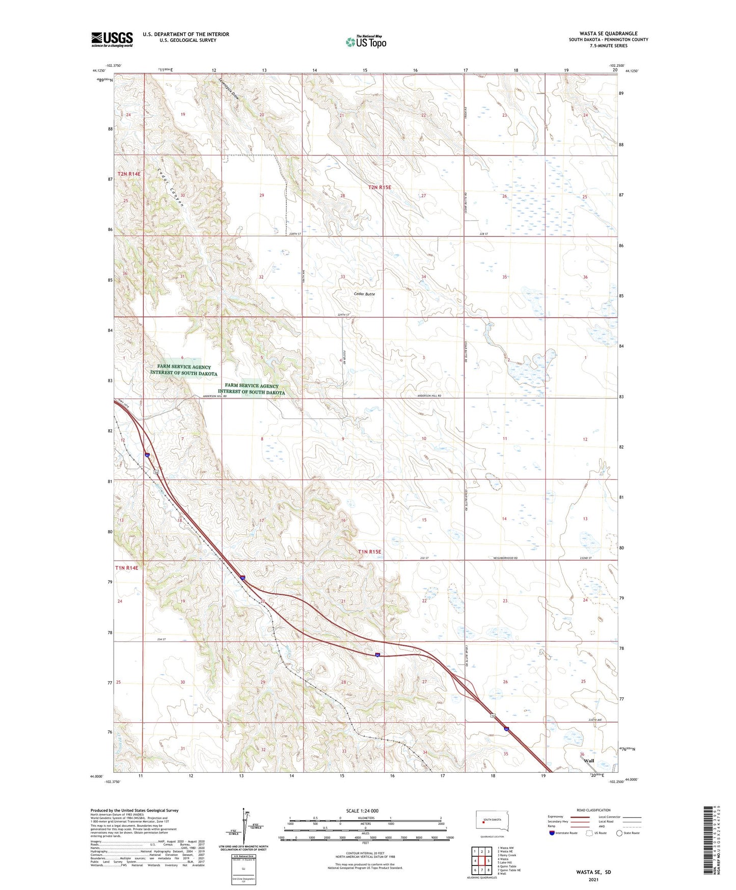
2021 topographic map quadrangle Wasta SE in the state of South Dakota. Scale: 1:24000. Based on the newly updated USGS 7.5' US Topo map series, this map is in the following counties: Pennington. The map contains contour data, water features, and other items you are used to seeing on USGS maps, but also has updated roads and other features. This is the next generation of topographic maps. Printed on high-quality waterproof paper with UV fade-resistant inks.
Quads adjacent to this one:
West: Wasta
Northwest: Wasta NW
North: Wasta NE
Northeast: Rainy Creek
East: Lake Hill
Southeast: Wall
South: Quinn Table NE
Southwest: Quinn Table
This map covers the same area as the classic USGS quad with code o44102a3.
Contains the following named places: Cedar Butte, Cedar Butte School, David Kitterman Dam, Frank Anderson Dam, Pennington Square School, Township of Cedar Butte, Township of Lake Flat