MyTopo
Alamo Tennessee US Topo Map
Couldn't load pickup availability
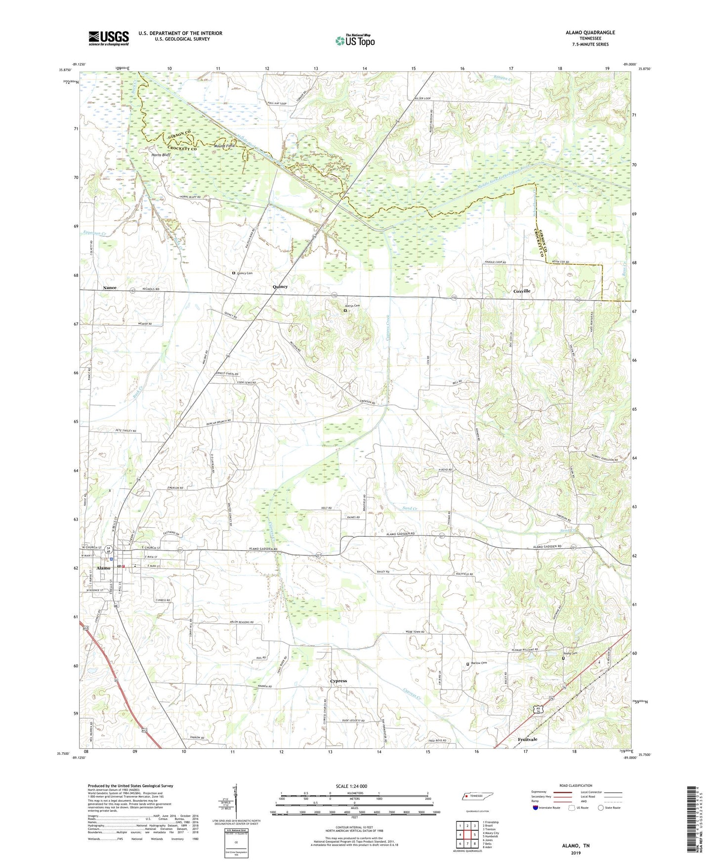
2022 topographic map quadrangle Alamo in the state of Tennessee. Scale: 1:24000. Based on the newly updated USGS 7.5' US Topo map series, this map is in the following counties: Crockett, Gibson. The map contains contour data, water features, and other items you are used to seeing on USGS maps, but also has updated roads and other features. This is the next generation of topographic maps. Printed on high-quality waterproof paper with UV fade-resistant inks.
Quads adjacent to this one:
West: Maury City
Northwest: Friendship
North: Brazil
Northeast: Trenton
East: Humboldt
Southeast: Adair
South: Bells
Southwest: Jones
This map covers the same area as the classic USGS quad with code o35089g1.
Contains the following named places: Alamo, Alamo Division, Alamo Fire Department, Alamo First Baptist Church, Alamo Police Department, Alamo Post Office, Averys Cemetery, Bailey School, Bear Creek, Brookdale School, Buck Creek, Center, Center Church, Central School, Commissioner District 6, Commissioner District 7, Commissioner District 8, Consolidated School, Coxs Chapel, Coxville, Crockett County Courthouse, Cypress, Cypress Creek, District 3, District 4, District 6, District 7, Emison School, Epperson Creek, Graham School, Hopewell School, Horns Bluff, Liberty Hall, Marlow Cemetery, Mound Field, Mount Olive Church, Nance, Oakview Memorial Park, Porters Grove, Porters Grove Church, Porters Grove School, Quincy, Quincy Cemetery, Salem Church, Sand Creek, Schoolhouse Creek, Town of Alamo, Vance School, WCTA-AM (Alamo), Young Cemetery, ZIP Code: 38337