MyTopo
Medina Tennessee US Topo Map
Couldn't load pickup availability
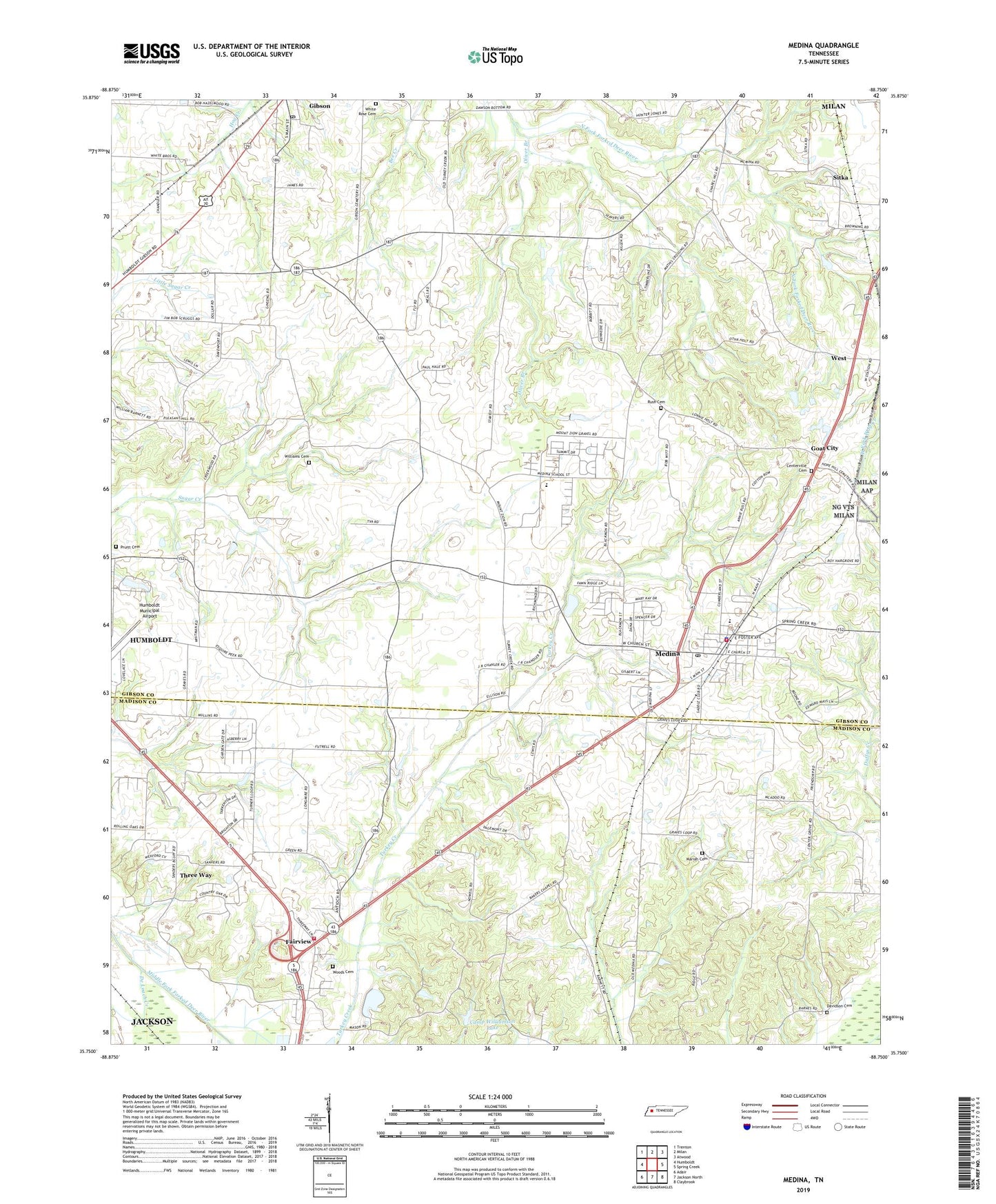
2022 topographic map quadrangle Medina in the state of Tennessee. Scale: 1:24000. Based on the newly updated USGS 7.5' US Topo map series, this map is in the following counties: Gibson, Madison. The map contains contour data, water features, and other items you are used to seeing on USGS maps, but also has updated roads and other features. This is the next generation of topographic maps. Printed on high-quality waterproof paper with UV fade-resistant inks.
Quads adjacent to this one:
West: Humboldt
Northwest: Trenton
North: Milan
Northeast: Atwood
East: Spring Creek
Southeast: Claybrook
South: Jackson North
Southwest: Adair
This map covers the same area as the classic USGS quad with code o35088g7.
Contains the following named places: Antioch Baptist Church, Bakers Chapel, Camp Williamson Lake, Camp Williamson Lake Dam, Centerville Cemetery, Chapel Grove Church, Chapel Hill Church, Chapel Hill School, City of Medina, City of Three Way, Commissioner District 1, Commissioner District 2, Commissioner District 3, Commissioner District 6, Davidson Cemetery, De Loach Creek, District 2, Fairview, Fairview School, Fly School, Friendship Church, Gibson High School, Gibson Post Office, Goat City, Madison County Fire Department Station 6, Mariah Cemetery, Medina, Medina Division, Medina Elementary School, Medina Fire Department, Medina First Baptist Church, Medina Police Department, Medina Post Office, Medina School, Moize Creek, Mount Zion Church, Mount Zion School, Oliver Branch, Pleasant Hill School, Pruitt Cemetery, Rush Cemetery, Sitka, Sitka Church of Christ, Sitka School, Three Way, Town of Gibson, West, West School, White Rose Cemetery, Williams Cemetery, Williams Chapel, Williams School, Woods Cemetery, WZDQ-FM (Humboldt), ZIP Code: 38355