MyTopo
Alpine Tennessee US Topo Map
Couldn't load pickup availability
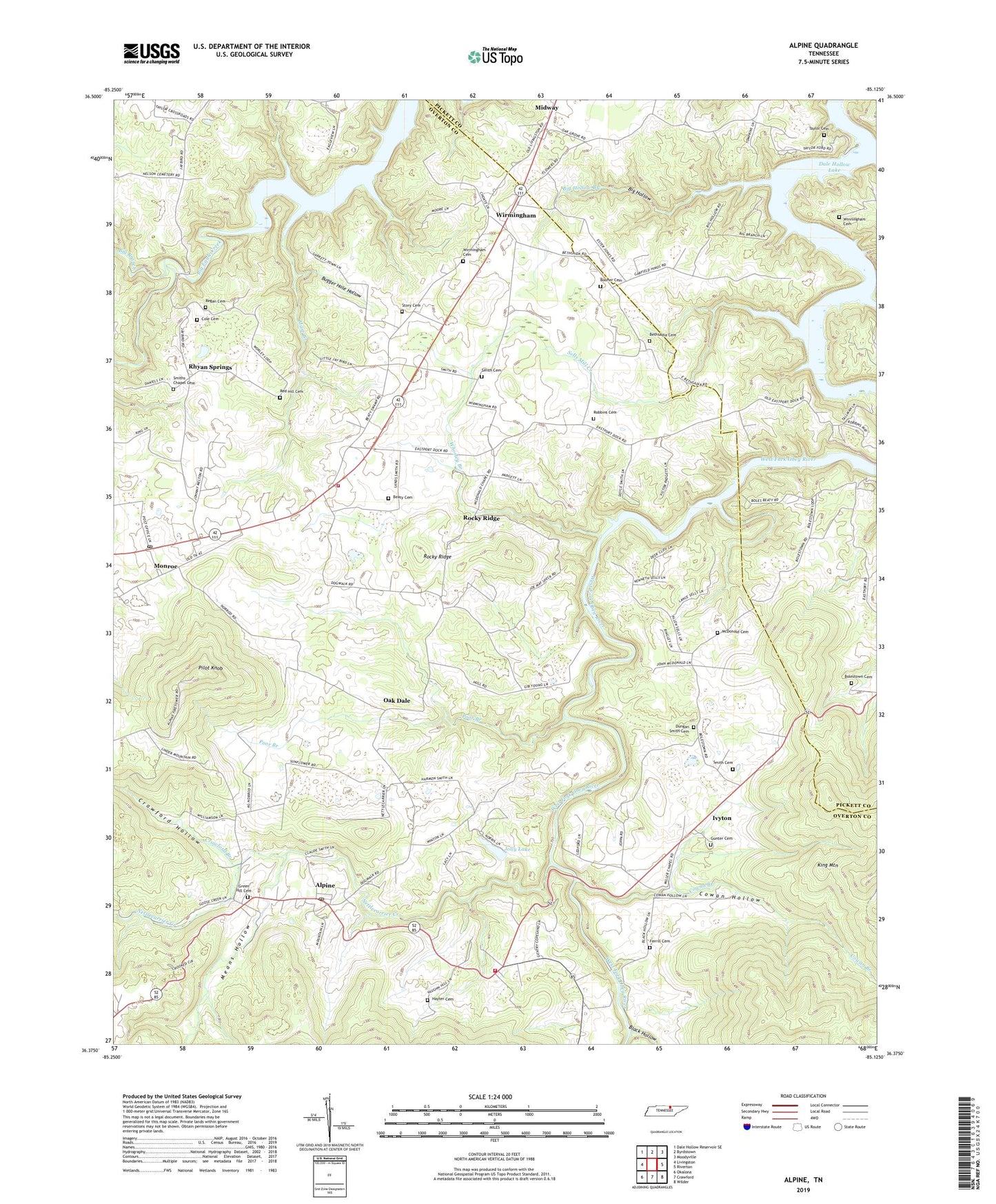
2022 topographic map quadrangle Alpine in the state of Tennessee. Scale: 1:24000. Based on the newly updated USGS 7.5' US Topo map series, this map is in the following counties: Overton, Pickett. The map contains contour data, water features, and other items you are used to seeing on USGS maps, but also has updated roads and other features. This is the next generation of topographic maps. Printed on high-quality waterproof paper with UV fade-resistant inks.
Quads adjacent to this one:
West: Livingston
Northwest: Dale Hollow Reservoir SE
North: Byrdstown
Northeast: Moodyville
East: Riverton
Southeast: Wilder
South: Crawford
Southwest: Okalona
This map covers the same area as the classic USGS quad with code o36085d2.
Contains the following named places: Alpine, Alpine Division, Alpine Post Office, Alpine School, Alpine Volunteer Fire Department, Beaty Cemetery, Bethsadia Cemetery, Bethsadie Church, Big Branch, Big Hollow, Big Hollow Branch, Black Hollow, Black Hollow Branch, Bolestown Cemetery, Bolestown Church, Booher Cemetery, Bugger Hole Hollow, Cole Cemetery, Cowan Branch, Cowan Hollow, Crawford Branch, Crawford Hollow, Dungan Smith Cemetery, Eagle Creek, Ferrill Cemetery, Green Hill Cemetery, Gunter Cemetery, Hayter Cemetery, Ivyton, Ivyton School, Jolly Lake, Jolly Lake Dam, Joppa School, Marr Branch, McDonald Cemetery, McDonald Chapel, Means Hollow, Miller Chapel, Monroe, Monroe Fire and Rescue, Monroe Post Office, Monroe School, Nettle Carrier, Nettlecarrier Creek, Oak Dale, Oak Grove Church, Pilot Knob, Poor Branch, Red Hill Cemetery, Regan Cemetery, Rhyan Springs, Robbins Cemetery, Rocky Ridge, Sells Mill Creek, Smith Cemetery, Smith Chapel, Smiths Chapel Cemetery, Story Cemetery, Taylor Cemetery, Westfork, Whorley Branch, Winningham Cemetery, Wirmingham, Wirmingham Cemetery, ZIP Code: 38573