MyTopo
Dale Hollow Reservoir SE Tennessee US Topo Map
Couldn't load pickup availability
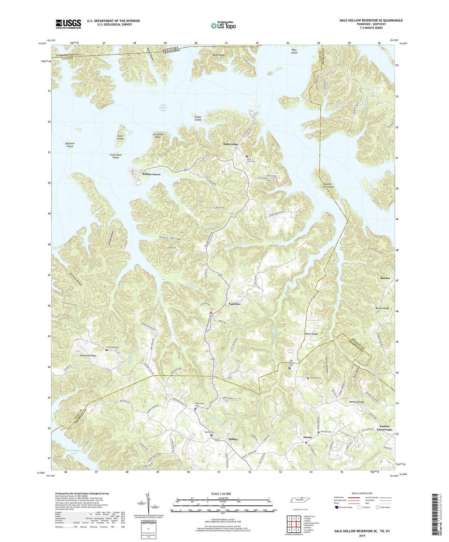
2022 topographic map quadrangle Dale Hollow Reservoir SE in the states of Tennessee, Kentucky. Scale: 1:24000. Based on the newly updated USGS 7.5' US Topo map series, this map is in the following counties: Clay, Overton, Pickett, Cumberland. The map contains contour data, water features, and other items you are used to seeing on USGS maps, but also has updated roads and other features. This is the next generation of topographic maps. Printed on high-quality waterproof paper with UV fade-resistant inks.
Quads adjacent to this one:
West: Dale Hollow Dam
Northwest: Blacks Ferry
North: Frogue
Northeast: Albany
East: Byrdstown
Southeast: Alpine
South: Livingston
Southwest: Hilham
This map covers the same area as the classic USGS quad with code o36085e3.
Contains the following named places: Accordion Bluff, Akers Lake, Akers Lake Dam, Allred Hollow, Antioch Cemetery, Antioch Church, Asburn Creek School, Ashburn Creek, Ashburns Creek Church of Christ, Barnes Ridge, Boom Ridge, Cedar Hill School, Chiltons Store, Chowning Cemetery, Chowning Knob, Colson Creek, Conner Cemetery, County Line Island, Dale Hollow Lake, East Clay Volunteer Fire Department, East Fork Ashburn Creek, Fairview, Fairview Church, Fairview Division, Fairview School, Fellowship Cemetery, Fellowship Church, Geiger Island, Goat Island, Heard Ridge, Heard School, Hendricks Creek, Hogan Hollow, Irons Creek, Johnson Bend, Jouett Creek, Lanear Creek, Lillydale, Lillydale Recreation Area, Lillydale School, Little Goat Island, Maple Grove Elementary School, Markham School, Martin Cemetery, Mohawk Ridge, Moore Hollow, Mount Lov School, Mount Pisgah Church, Muddy Branch, Oakley, Old Bethel Cemetery, Onvy Hollow, Opossum Island, Ozone, Ozone School, Pleasant Hill Church, Pleasant Hill School, Pusley Creek, Rocky Branch, Saint John, Saint John Cemetery, Saint Johns Church, Saint Johns School, Sidwell Creek, Stillhouse Creek, Sulphur Creek, Summer Shade Church, Summer Shade School, Taylors Crossroads, Taylors Crossroads Methodist Church, Taylors Crossroads Volunteer Fire Department, Taylors Store, Tipton Hollow, West Fork Ashburn Creek, Wiley Fork, Willis Bottom, Willow Grove, Willow Grove Dock, Willow Grove Recreation Area, Willow Grove School, Wolf River, ZIP Code: 38541