MyTopo
Moodyville Tennessee US Topo Map
Couldn't load pickup availability
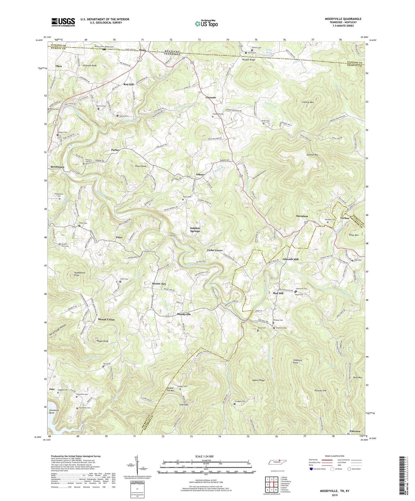
2022 topographic map quadrangle Moodyville in the states of Tennessee, Kentucky. Scale: 1:24000. Based on the newly updated USGS 7.5' US Topo map series, this map is in the following counties: Pickett, Fentress, Clinton. The map contains contour data, water features, and other items you are used to seeing on USGS maps, but also has updated roads and other features. This is the next generation of topographic maps. Printed on high-quality waterproof paper with UV fade-resistant inks.
Quads adjacent to this one:
West: Byrdstown
Northwest: Albany
North: Savage
Northeast: Powersburg
East: Pall Mall
Southeast: Jamestown
South: Riverton
Southwest: Alpine
This map covers the same area as the classic USGS quad with code o36085e1.
Contains the following named places: Adkins Ridge, Amonette Cemetery, Asbury, Asbury Chapel, Back Creek, Back Creek School, Backbone Ford, Beatty Mill, Begley Branch, Boiling Spring, Buck Mountain, Caney Creek, Cedar Grove, Cedar Hill School, Chanute, Chanute Campbell Cemetery, Chanute School, Chapman Branch, Clark Cemetery, Clark School, Commissioner District 1, Conley Crossroads, Cooks Mill, Davidson, Davidson Cemetery, Davidson School, Delk Cemetery, Double Top Mountain, Dry Creek, Dry Creek School, Duncan Sink, Edgefield Church, Etter, Etter Baptist Church, Etter School, Fairview Cemetery, Falling Waters Hollow, Flowers Cemetery, Flowers-Zachary Cemetery, Franklin Creek, Garrett Cemetery, Gilreath Mill, Golman Mountain, Hildreth Knob, Holbert Creek, Huddleston Cemetery, Huddleston Knob, Lick Creek, Littoral Mountain, Moodyville, Moodyville Baptist Church, Moodyville School, Mount Airy, Mount Union, Mount Union School, Mullins Cemetery, Okra, Paggett Cemetery, Parker, Parker School, Parris - Riley Cemetery, Pickett County, Piles Branch, Poore Cemetery, Poore Knob, Porter Poole Mill, Pulse Cemetery, Pulse Mill, Rains Store, Reagan and Gibson Mine, Rector Cemetery, Red Hill, Red Hill Church, Red Hill Methodist Church, Red Hill School, Regan Knob, Rich Cemetery, Riley Ford, Russell Cemetery, Russell Ridge, Scott Rich Cemetery, Scroggins Cemetery, Shadow Cemetery, Sinking Spring Church, Smith - Koger Cemetery, South Ford, South Lick Creek Branch, Static, Static Division, Step Gap, Stephens Cemetery, Stephens Point, Sulphur Springs, Town Branch, Travis Cemetery, United Church, Upchurch Cemetery, Widow Creek, Williams School, Wright Branch, Wright Cemetery