MyTopo
Deason Tennessee US Topo Map
Couldn't load pickup availability
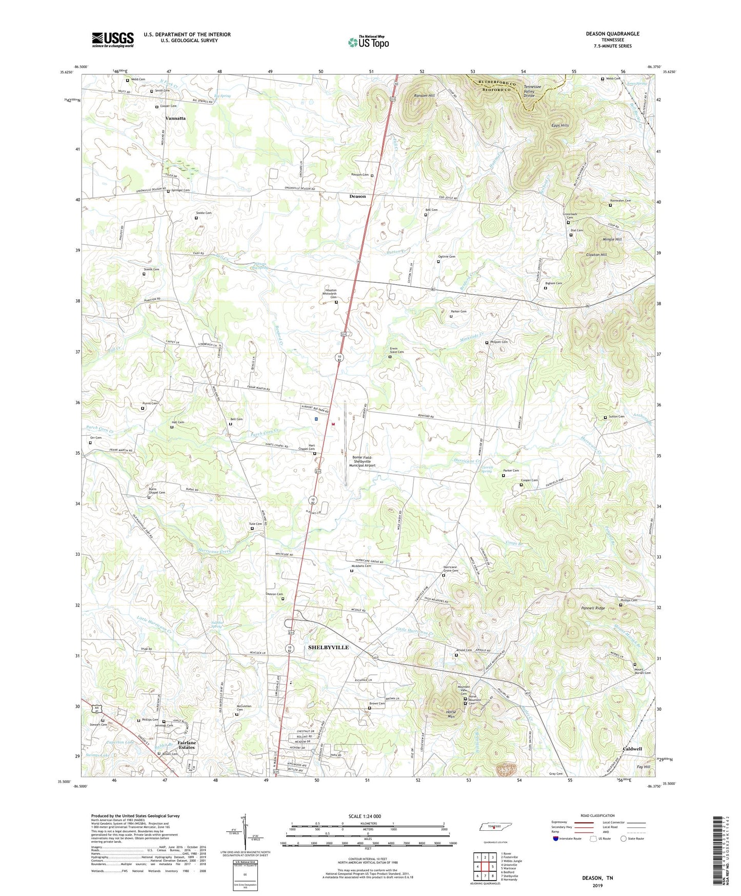
2022 topographic map quadrangle Deason in the state of Tennessee. Scale: 1:24000. Based on the newly updated USGS 7.5' US Topo map series, this map is in the following counties: Bedford, Rutherford. The map contains contour data, water features, and other items you are used to seeing on USGS maps, but also has updated roads and other features. This is the next generation of topographic maps. Printed on high-quality waterproof paper with UV fade-resistant inks.
Quads adjacent to this one:
West: Unionville
Northwest: Rover
North: Fosterville
Northeast: Webbs Jungle
East: Wartrace
Southeast: Normandy
South: Shelbyville
Southwest: Bedford
This map covers the same area as the classic USGS quad with code o35086e4.
Contains the following named places: Arnold Cemetery, Bedford County, Bedford County Emergency Medical Service, Bedford County Farm, Bell Cemetery, Benford Creek, Big Spring, Bigham Cemetery, Blue Moon Farms, Bomar Academy, Bomar Field-Shelbyville Municipal Airport, Bridlewood Farm, Brown Cemetery, Burns Chapel Cemetery, Burns Church, Caldwell, Caperton Lake, Carrick Spring, Central School, Claxton Hill, Commissioner District 2, Commissioner District 8, Cooper Cemetery, Coops Academy, Coops Branch, Crossroads Cemetery, Crossroads Church, Damron Cemetery, Deason, Deason Church of Christ, Dial Cemetery, Eakin Elementary School, Epps Hills, Erwin Slave Cemetery, Fairfield Farm, Fairlane Estates, Hall Cemetery, Harris Store, Hart Chapel Cemetery, Harts Chapel, Harts Chapel School, Hictons Big Spring, Horse Mountain, Horse Mountain Cemetery, Horse Mountain Church, Houston Whitworth Cemetery, Hurricane Creek Church, Hurricane Grove Cemetery, Hurricane Grove Church, Hutton Creek, Jennings Cemetery, Jones Spring, Mc Adams Cemetery, Mc Cuistion Cemetery, McDale School, Mingle Hill, Minkslide Creek, Mount Moriah Cemetery, Mount Moriah Church, Mount View Church, Mountain View Cemetery, Northside Church, Ogilivie Cemetery, Orr Cemetery, Pannell Ridge, Parker Cemetery, Philippi United Methodist Church, Phillippi Church, Phillips Cemetery, Philpott Cemetery, Purvis Cemetery, Rainwater Cemetery, Ransom Cemetery, Ransom Hill, Ranson Church, Saddlecrest Farms, Sand Creek Farms, Shady Grove School, Shelbyville Fire Department Station 3, Smith Cemetery, Springer Cemetery, Steele Cemetery, Stewart Cemetery, Sulphur Spring, Sulphur Springs School, Sutton Cemetery, Swings Lake, Tennova Healthcare System Shelbyville, Trinity Southern Methodist Church, Tune Cemetery, Vannatta, Webb Cemetery, Whiteside United Methodist Church, WYCQ-FM (Shelbyville)