MyTopo
Bonicord Tennessee US Topo Map
Couldn't load pickup availability
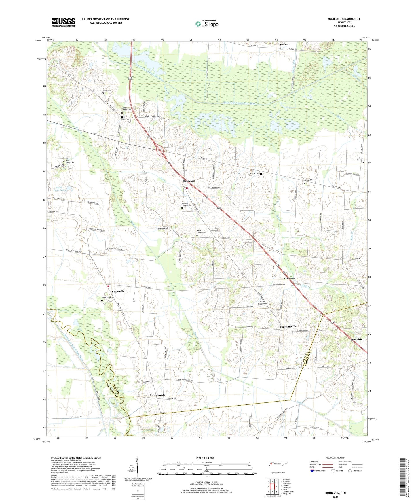
2022 topographic map quadrangle Bonicord in the state of Tennessee. Scale: 1:24000. Based on the newly updated USGS 7.5' US Topo map series, this map is in the following counties: Dyer, Crockett, Lauderdale. The map contains contour data, water features, and other items you are used to seeing on USGS maps, but also has updated roads and other features. This is the next generation of topographic maps. Printed on high-quality waterproof paper with UV fade-resistant inks.
Quads adjacent to this one:
West: Fowlkes
Northwest: Dyersburg
North: Newbern
Northeast: Tatumville
East: Friendship
Southeast: Maury City
South: Chestnut Bluff
Southwest: Gates
This map covers the same area as the classic USGS quad with code o35089h3.
Contains the following named places: Beech Grove, Beech Grove Church, Bonicord, Bonicord Volunteer Fire Department, Bruceville, Bruceville Volunteer Fire Department, Cain Creek, Clark Farm Lake, Clark Farm Lake Dam, Clay Cemetery, Commissioner District 1, Cross Roads, District 2, District 3, Eliza Creek, Fowlkes Division, Halls Creek, Hawkinsville, Hillcrest School, Hodge Cemetery, Holly Spring Cemetery, Island Number Five, Jones Cemetery, Miller Chapel, Miller Chapel Cemetery, Mount Moriah Church, Mount Pisgah Cemetery, Nash Cemetery, Nash Creek, Palestine Cemetery, Palestine Church, Parker, Parker Ditch, Parrish Chapel, Saint Peter Cemetery, Shelton Cemetery, Sorrell Chapel, Sorrell Chapel Cemetery, Stokes Creek, Tigrett Wildlife Management Area, Walker Cemetery, Williams Chapel Cemetery, Zion Hill Church