MyTopo
Tatumville Tennessee US Topo Map
Couldn't load pickup availability
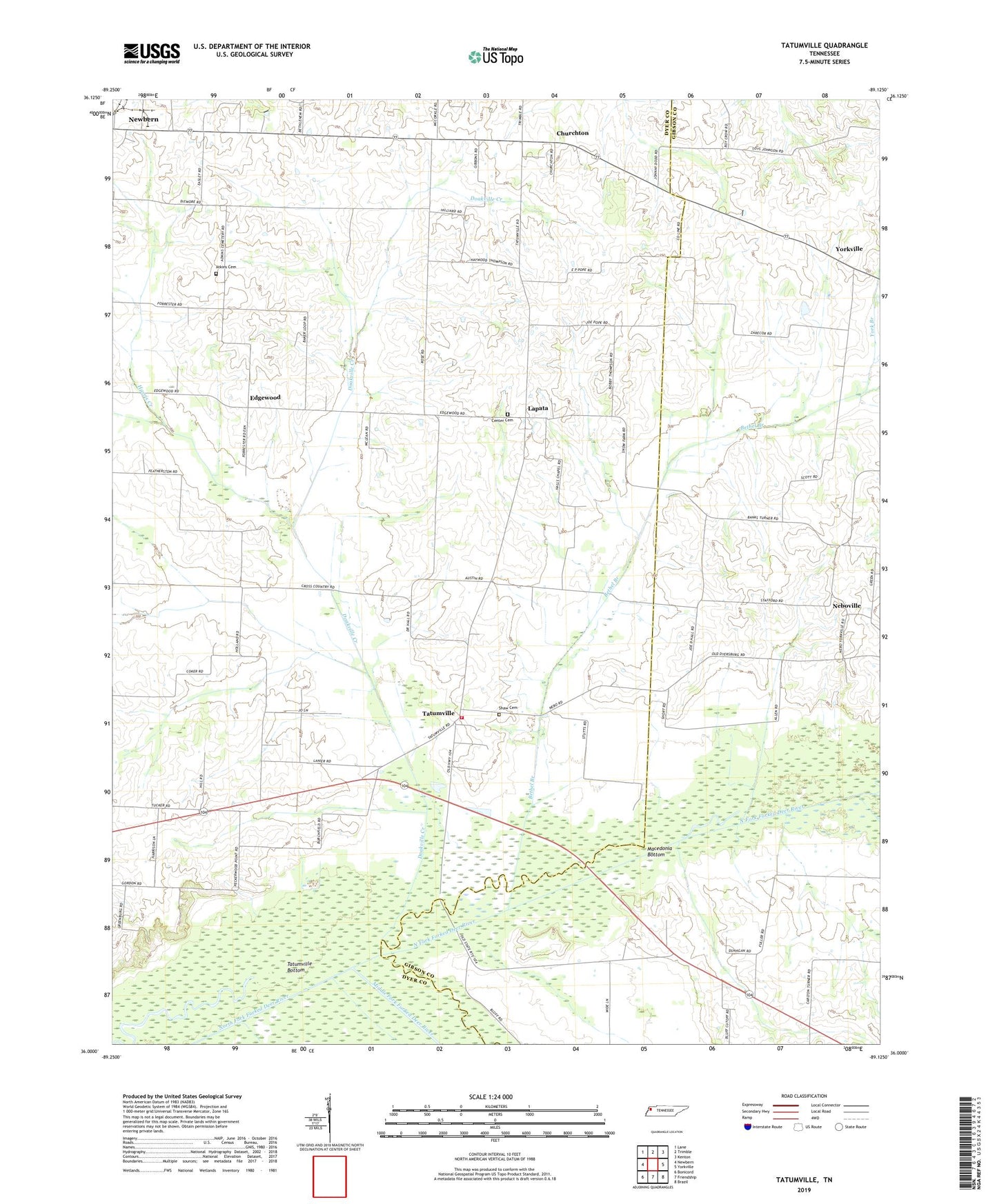
2022 topographic map quadrangle Tatumville in the state of Tennessee. Scale: 1:24000. Based on the newly updated USGS 7.5' US Topo map series, this map is in the following counties: Dyer, Gibson, Crockett. The map contains contour data, water features, and other items you are used to seeing on USGS maps, but also has updated roads and other features. This is the next generation of topographic maps. Printed on high-quality waterproof paper with UV fade-resistant inks.
Quads adjacent to this one:
West: Newbern
Northwest: Lane
North: Trimble
Northeast: Kenton
East: Yorkville
Southeast: Brazil
South: Friendship
Southwest: Bonicord
This map covers the same area as the classic USGS quad with code o36089a2.
Contains the following named places: Arratt Chapel, Atkins Cemetery, Bethel Branch, Center Cemetery, Churchton, College Hill School, Commissioner District 3, District 8, Doakville Creek, East Dyer County Volunteer Fire Department, Edgewood, Edgewood School, Forks of the River, Halls Chapel, Harris Creek, Lapata, Lemalsamac Church, Lisbon School, Macedonia Bottom, Mayfield Church, Middle Fork Forked Deer River, Mount Olive Church, Mount Tirzah Church, Neboville, Neboville School, Potatoe, Shaw Cemetery, Squirt Creek, Summerview School, Tatumville, Tatumville Bottom, Tatumville Church, Tatumville School, The Center Church, York Branch, ZIP Code: 38059