MyTopo
Friendship Tennessee US Topo Map
Couldn't load pickup availability
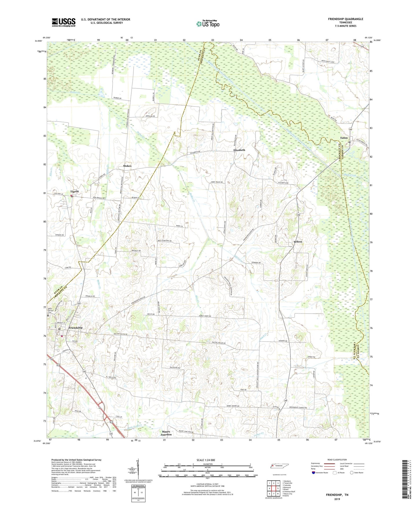
2022 topographic map quadrangle Friendship in the state of Tennessee. Scale: 1:24000. Based on the newly updated USGS 7.5' US Topo map series, this map is in the following counties: Crockett, Dyer, Gibson. The map contains contour data, water features, and other items you are used to seeing on USGS maps, but also has updated roads and other features. This is the next generation of topographic maps. Printed on high-quality waterproof paper with UV fade-resistant inks.
Quads adjacent to this one:
West: Bonicord
Northwest: Newbern
North: Tatumville
Northeast: Yorkville
East: Brazil
Southeast: Alamo
South: Maury City
Southwest: Chestnut Bluff
This map covers the same area as the classic USGS quad with code o35089h2.
Contains the following named places: Allens Chapel, Bellevernon Cemetery, Bethel Chapel, Bethesda Church, Bowen Chapel, Buck Creek, City of Friendship, College Hill School, Commissioner District 1, District 1, District 12, District 15, District 9, Eaton, Eaton Post Office, Elizabeth, Friendship, Friendship Baptist Church, Friendship Division, Friendship Elementary School, Friendship Fire and Police Department, Friendship Fire Department, Friendship Post Office, Greenhill Church, Hodson, Miller Creek, Mount Zion Church, Odell Creek, Providence Church, Rice Creek, Stokes, Tigrett, Tigrett Post Office, Tigrett Volunteer Fire Department, Tucker Creek, Wilcox, Williams Chapel, ZIP Codes: 38021, 38034, 38070