MyTopo
Gates Tennessee US Topo Map
Couldn't load pickup availability
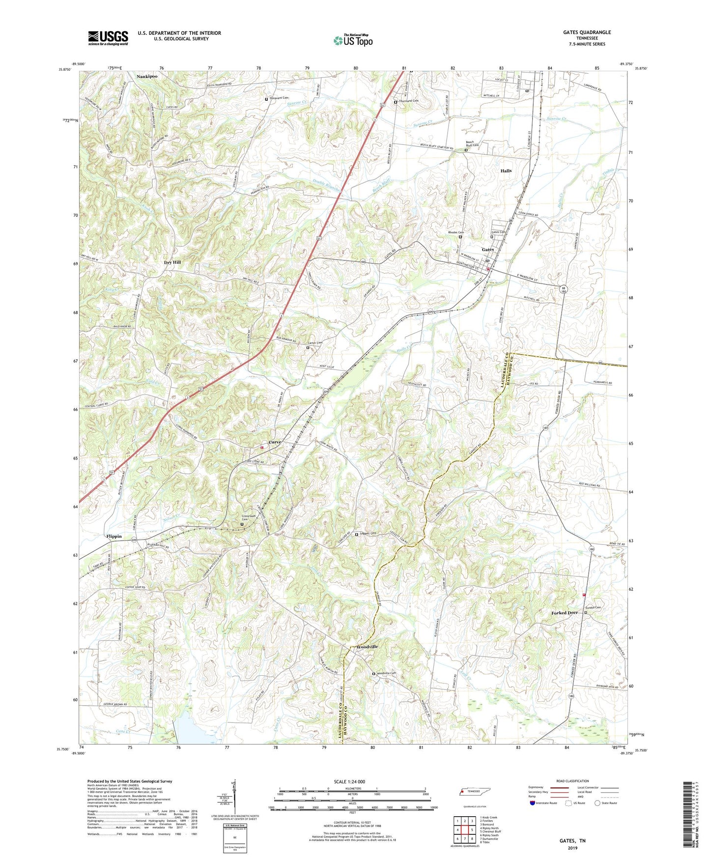
2022 topographic map quadrangle Gates in the state of Tennessee. Scale: 1:24000. Based on the newly updated USGS 7.5' US Topo map series, this map is in the following counties: Lauderdale, Haywood. The map contains contour data, water features, and other items you are used to seeing on USGS maps, but also has updated roads and other features. This is the next generation of topographic maps. Printed on high-quality waterproof paper with UV fade-resistant inks.
Quads adjacent to this one:
West: Ripley North
Northwest: Knob Creek
North: Fowlkes
Northeast: Bonicord
East: Chestnut Bluff
Southeast: Tibbs
South: Durhamville
Southwest: Ripley South
This map covers the same area as the classic USGS quad with code o35089g4.
Contains the following named places: Abernathy, Antioch Church, Beech Bluff Cemetery, Beech Bluff Creek, Brownsville - Haywood County Fire Department District 6, Cane Creek Watershed Dam Fourteen A, Carter Cemetery, Commissioner District 7, Concord Church, Cross Roads School, Crossroads Cemetery, Curve, Curve Baptist Church, Curve Post Office, Curve School, Double Branches, Dry Hill, Dry Hill Church, Dunavant Cemetery, East Lauderdale County Volunteer Fire Department, Enon Church, Eureka Cemetery, Eureka Church, Flippin, Flippin Post Office, Forked Deer, Forked Deer School, Gates, Gates Cemetery, Gates Division, Gates Fire Department, Gates Post Office, Gates School, Halls Post Office, Lauderdale County Landfill, Leggett Cemetery, Lillian Fountain School, McKingons Store, Mount Pleasant Church, Mount Pleasant School, Nankipoo, Nelson Chapel, Rhodes Cemetery, Sunrow Creek, Thurmand Cemetery, Town of Gates, Trinity Church, Whitefield Church, Woodville, Woodville Baptist Church, Woodville Cemetery, Woodville Post Office, Woodville School, ZIP Code: 38037